

Image
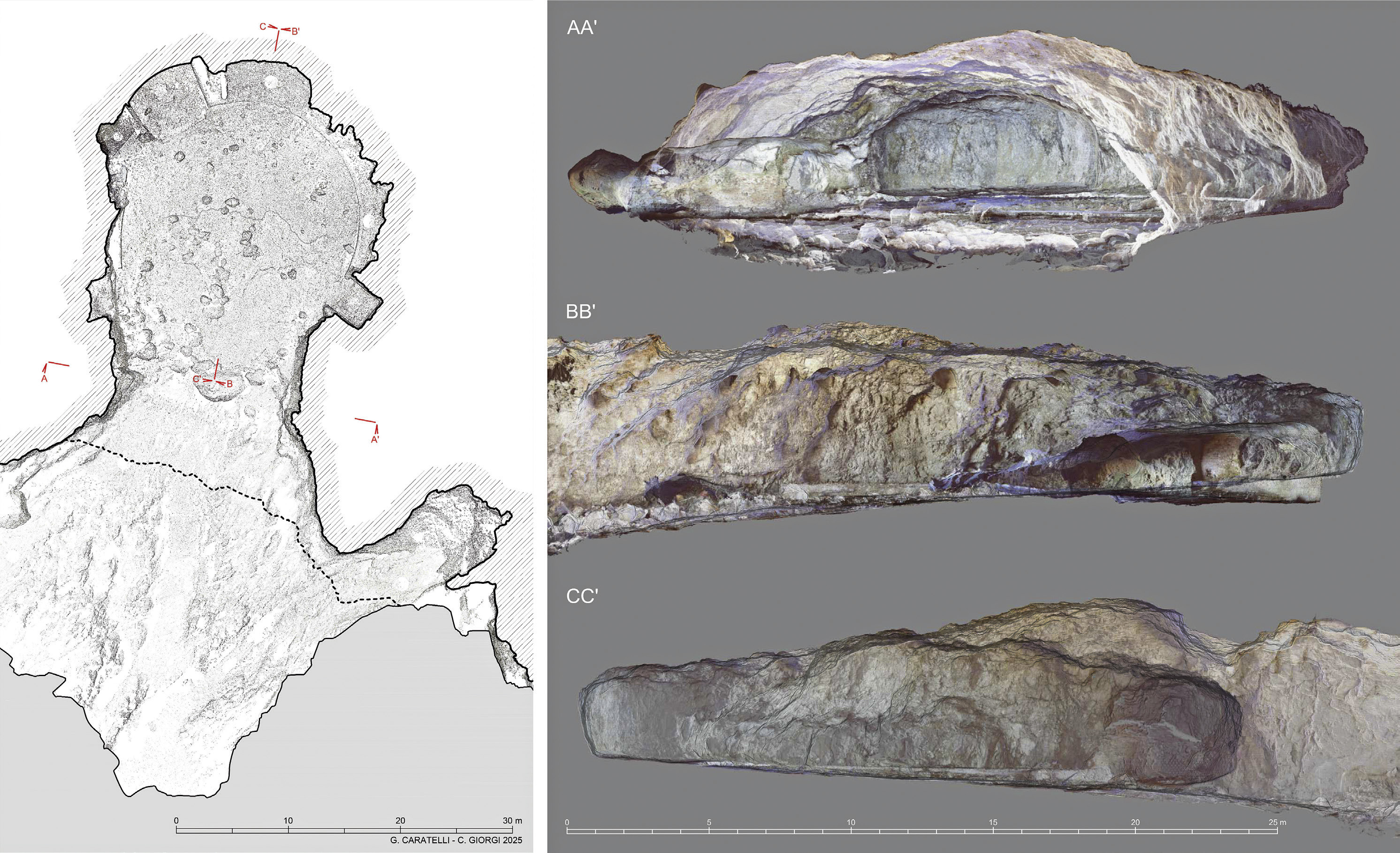
Capri, Grotta dell’Arsenale. Plan and sections from the 3D point cloud model
- Title
- Capri, Grotta dell’Arsenale. Plan and sections from the 3D point cloud model
- Creator(s)
- Giovanni CaratelliSee all media with this value
- Cecilia GiorgiSee all media with this value
- Description
- Figura 2 da Caratelli G., Giorgi C., Paraciani N. 2025, From archaeological survey to data accessibility: a WebGIS for the island of Capri, «Archeologia e Calcolatori», 36.1, 65-86 (https://doi.org/10.19282/ac.36.1.2025.04)
- Date
- 2025
- Spatial Coverage
- Capri
- Format
- digital images
- Identifier
- 1446
- Subject
- plans (orthographic projections)
- cross sections (orthographic projections)
- virtual models
- photogrammetry
- archaeological sites
- Is Part Of
- https://www.archcalc.cnr.it/journal/articles/1377
- File Format
- png
- Rights Holder
- CC BY NC ND 4.0
Export
Part of From Archaeological Survey to Data accessibility: a webgis for the Island of Capri
Position: 2045 (13 views)