The Sapienza University of Rome Archaeological Mission in Arabian Peninsula and Gulf Area (Missione Archeologica della Sapienza nella Penisola Arabica e nel Golfo – MASPAG) has been founded in 2020 in the Department of Science of Antiquities and in the long-standing research and pedagogic traditions of the Italian schools of the Near East Archaeology, History and Art History. Thanks to an experience of many years of excavations, surveys and conservations research crossing Eurasia from north-western Syria to south-eastern Arabia, MASPAG’s members plans, follows and supports different interdisciplinary projects in the Arabian Peninsula and Persian Gulf collaborating with many national and international institutions and laboratories, researchers and scholars for exploring, safeguarding and promoting the tangible and intangible heritages of ancient nomad and sedentary cultures, with specific attention to biological and anthropological approaches. MASPAG is now involved in the promotion of an Atlas of the Ancient Near East financed by Sapienza as a Great Athenaeum Project in 2016 and in field research in Oman as Great Athenaeum Excavation (2019, 2020, 2021).
An exhaustive digital Archaeological Atlas of Coptic Literature provides a new comprehensive perspective on the spread and development of Coptic literature and manuscript culture. This versatile tool allows detailed and focused research and correlation of chronological, regional and thematic data. It also illustrates the relationship between settlements uncovered by the archaeological and topographical investigations and intellectual activity revealed in manuscripts.
The Archaeological Atlas of Coptic Literature is based on a central web database will be continuously updated in the future. The database is composed of seven fundamental parts (entities), dedicated to Places, Manuscripts, Works, Authors, Titles, Colophons, and Collections. Each part addresses specific issues and follows its own methodological guidelines and descriptive protocols which are closely linked to each other in a network pattern that draws it strength from these links. The principal aim is to provide the literary and manuscript tradition with a sound archaeological and geographical context and vice-versa.
The Atlas gives full access to the main database and provides different types of search experience, from the easiest (and easy to perform) to the most refined and granular.
To help and guide users towards interesting research results some default search filters are prepared and made available, ready to be run and visualised. These “Saved queries” are available for single parts and for geographic data visualisation. The welcome page of the Atlas shows by default all Places that are related to Coptic Literary Manuscripts, and by disabling the filter in the left bar all recorded Places are shown. Amongst other products, PAThs presently includes:
- A complete classification of the Coptic manuscript tradition, by means of the attribution of stable identifiers for each manuscript (codicological unit), in order to have univocal coordinates of reference for the entirety of Coptic literary production. Such a classification can be progressively expanded as new manuscripts are discovered.
- A detailed codicological description of part of the codicological units (to be expanded progressively).
- A complete classification of Coptic literature, by means of the attribution of a Clavis Coptica (CC) entry for each work and each title, and of a stable identifier for each colophon.
- A complete census of the relevant places, including sites where individual manuscripts (for instance codices buried with a body, as a funerary kit) or entire ‘collections’ (for example a monastery library) have been found; major Late Antique and Medieval archaeological sites, as known from published reports; other places of political, religious, and cultural significance (like episcopal sees), even when they have left no specific physical trace or evidence.
- A census, edition, and translation of Coptic titles.
- A census, edition, and translation of Coptic colophons.
- A classification of book formats, writing supports and other relevant codicological features of the manuscripts, in relation to the texts that they transmit.
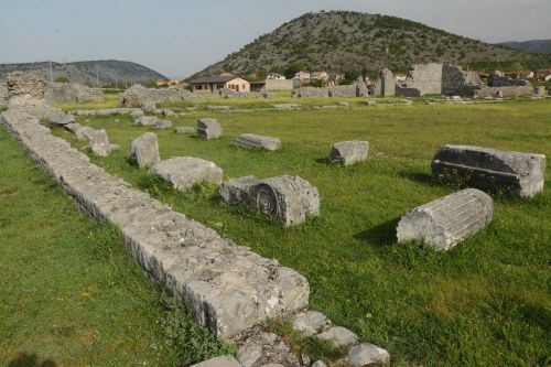
Il Laboratorio (ArcheoLab Italia Montenegro), dal titolo 'Archaeological survey in the Doclea valley (Podgorica, Montenegro): walking from Prehistory to early Medieval ages', ha lo scopo di ridare nuova vita ad un sito poco valorizzato, ma estremamente importante per l’identità culturale montenegrina. Oggetto del laboratorio è, infatti, l’antica città romana di Doclea, situata a pochi chilometri dalla capitale del Montenegro, Podgorica.
Climate change is one of the biggest challenges facing our planet today. From seasonal shifts in climate, with droughts, heatwaves, floods and storms, the impacts of climate change are global in scope and unprecedented in scale. Cities will face frequent extreme events in future years. The risk to cultural heritage and historic urban centres from climate change is also going to increase. The EU-funded ARCH project will develop a disaster risk management framework for assessing and improving the resilience of historic areas to climate change and natural hazards. Tools and methodologies will be designed for local authorities and practitioners, the urban population, and national and international expert communities. To support decision-making, the project will present various models, methods, tools and datasets. These will be developed in collaboration with the four European municipalities Bratislava, Camerino, Hamburg, and València.
ArcGIS Pro is the premier desktop geographic information system (GIS) application. Crafted with user-driven innovations, it offers unparalleled tools and capabilities that support your work. Users can maintain spatial data effectively; generate stunning 2D, 3D, and 4D visualizations; and conduct advanced mapping analytics. The seamless data sharing within the ArcGIS system fosters valuable GIS solutions and insights.
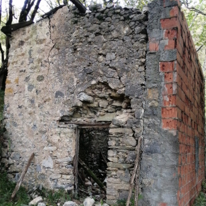
Le “montagne di mezzo” sono quelle aree non propriamente collinari, ma nemmeno di alta quota, in cui lo spazio abitabile rappresenta una mediazione dialettica con condizioni fisiche mutevoli. [...] Il progetto ARAM propone l’indagine di queste aree attraverso una archeo-antropologia dell’abbandono finalizzata a rivitalizzare ciò che è stato trascurato, con uno sguardo sui resti del passato che esuli dall’idea classica di patrimonializzazione: l’abbandono come elemento caratterizzante gli spazi, che da privati diventano comuni, per esplorare progettualità alternative; l’abbandono come risorsa, bene collettivo, che può dare vita a esperienze di manutenzione, alla creazione di nuove mappe e di progettualità sovralocali.
Application of Close-Range SfM Photogrammetry on three bases of Etruscan Bronze Candelabra from Spina Necropolises.
This dataset contains the photogrammetry made 3D models of three Etruscan Bronze Candelabra found at Spina, dated to the 4th cent. BC, kept in the Archaeological Museum of Ferrara.
The models were made through Agisoft Metashape from previously taken RAW photos, at the National Archaeological Museum of Ferrara, for master thesis purposes. Some minor issues of the meshes were solved using Blender before texturing the models.
The folders are divided according to the tombs of provenance of the candelabra (T. 545, T. 1122, T. Unknown) and every folder contain: The OBJ, The texture, An additional folder with the reports generated from Agisoft Metashape.
Applanix POSPac UAV®, now with Applanix POSPac® Trimble Post-Processed CenterPoint® RTX™ (PP-RTX®), is a next generation, industry-leading software for Direct Georeferencing of UAV/Drone mapping sensors using GNSS and inertial technology. It is tailored to the UAV/Drone market supporting Trimble APX products. This smart software solution achieves both maximum accuracy and maximum efficiency for Direct Georeferencing. Compared to Applanix POSPac MMS® it is a smaller software package focussing on UAV application.
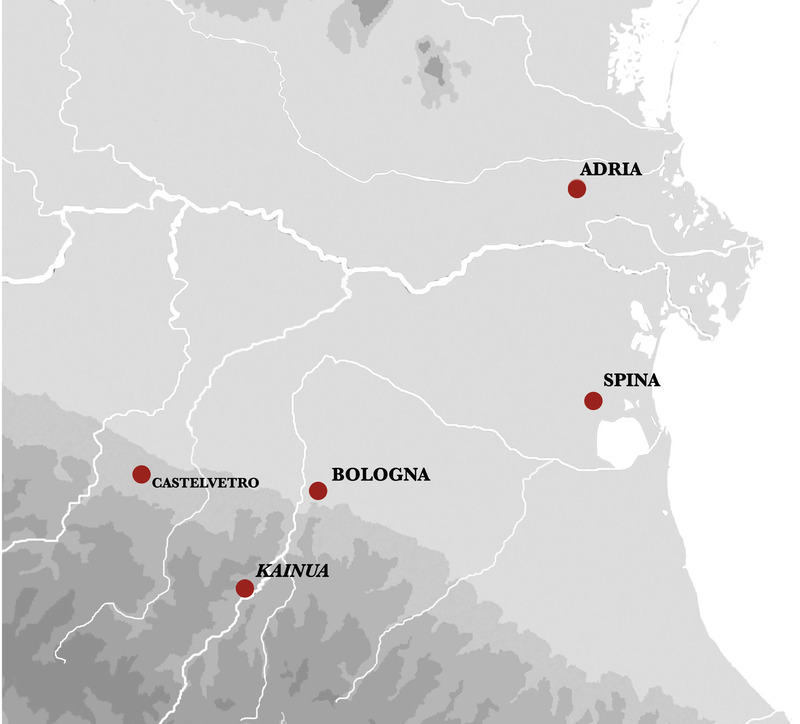
Il progetto Appenninica, finanziato dal bando competitivo ALMAIDEA 2022, mira a mappare i siti delle vallate appenniniche del Reno e dei suoi affluenti, Setta e Limentra, per definire le strategie di occupazione e le forme di viabilità di questo settore appenninico tra VI e IV sec. a.C.
The city of Apollonopolis Magna was located on the west bank of the Nile, south of Thebes. As the seat of Horus, Greeks regarded it as a site connected with Apollo. It served as the capital of the second nome of Upper Egypt.
The Apolline Project is a multi-disciplinary research project which seeks to bring to light the hitherto neglected past of the area to the north of the spectacular Mt. Vesuvius and the Apennines.
APENNINESCAPE esplora le dinamiche tra insediamenti umani, risorse naturali e paesaggio nell'Appennino settentrionale, con particolare attenzione ai distretti vallivi del Reno, Bisenzio e Sieve. Il periodo di riferimento è il I millennio a.C., quando le comunità etrusche delle Valli del Po e dell’Arno svolgevano un ruolo cruciale nello sviluppo socio-politico della regione.
La mappatura delle evidenze archeologiche rappresenta l’azione preliminare per la comprensione del popolamento.
Il progetto ha previsto una prima raccolta di tutte le informazioni disponibili per l’elaborazione di un GIS correlato di tabelle attribuiti dedicate ai siti e ai campioni delle analisi archeometriche.
Per questo scopo sono stati consultati gli archivi storici del territorio (Archivio Topografico del Museo Civico Archeologico di Bologna; Archivio Topografico e Storico presso la Soprintendenza Archeologia, belle arti e paesaggio per la città metropolitana di Bologna e le province di Modena, Reggio Emilia e Ferrara), integrati con la documentazione edita negli anni.
Il cuore del progetto APENNINESCAPE è un database georeferenziato che integra dati archeologici, geomorfologici e ambientali. Realizzato con tecnologie open-source, il database raccoglie informazioni su siti, risorse naturali e percorsi storici, offrendo una piattaforma unica per l'analisi e la condivisione.
Grazie a strumenti GIS avanzati, il database supporta modelli predittivi per identificare nuovi insediamenti e tracciare antiche rotte transappenniniche. Accessibile a diversi livelli, dai ricercatori agli stakeholder locali, rappresenta uno strumento fondamentale per valorizzare il patrimonio territoriale e promuovere la conoscenza del passato.