engDatasets and tools related to the design, use, and integration of structured databases in archaeological research, including relational and graph-based models.
Questo webGIS è stato concepito per permettere all'utente di accedere ai contenuti dell'Archivio Disegni esplorando la pianta del parco archeologico. L'elenco degli edifici i cui disegni sono presenti nell'archivio, sulla sinistra della pagina, si aggiorna in base alla porzione di mappa visualizzata. Nella casella di ricerca è possibile inserire il nome di un luogo specifico o di una tipologia (ad esempio 'mitreo') per filtrare i risultati.
VNM sta realizzando il primo database intelligente e multimediale di tutti i reperti archeologici provenienti dall’area di Vulci, ora disseminati nei musei e nelle collezioni italiane e mondiali.
Vulci (fl. 10th cent. BCE- 5th cent. CE) was one of the largest and most important cities of ancient Etruria and one of the biggest pre-Roman cities in the 1st millennium BCE in the Italian peninsula. The investigation of Vulci presents a rare opportunity to study city-plans and urban infrastructures and for interpreting the organization of public spaces across time and cultures. The emergence of Vulci as an Etruscan settlement and its transformation into a Roman city involved important political, religious, and social changes, identifiable by comparative analyses between architectural spaces, trade and materials’ production. Duke’s excavations in the urban core identified over 6000 classifiable objects in different categories (pottery, coins, tools, architectural elements, metal, and wall decorations) which will contribute significantly to the study of urban archaeology in the Italian peninsula. Anticipating the power of 3D data and virtual reality for preserving, studying and communicating information about this unique site, the excavations at Vulci are entirely documented in 3D thanks to a combined use of 3D photogrammetry, georadars, multispectral drones and laser scanners. Vulci team has made use of VR tools (Unity 3D, Oculus Quest, HTC Vive) to create example immersive experiences. This project was generously supported by the following sponsors: Soprintendenza Archeologia Belle Arti e Paesaggio per l'area metropolitana di Roma, la provincia di Viterbo e l'Etruria meridionale; the Etruscan Foundation, and The Gladys Krieble Delmas Foundation.
Un primo catalogo digitale delle caratteristiche geochimiche e petrografiche dei materiali lapidei utilizzati per la costruzione a Pisa tra età Romana e Medioevo.
MedAfriCarbon radiocarbon database and web app are outcomes of the MedAfrica Project —Archaeological deep history and dynamics of Mediterranean Africa, ca. 9600-700 BC. The dataset presented here includes a collection of 1584 calibrated archaeological 14C dates from 1587 samples collected from 368 sites located in Mediterranean Africa (plus some additional dates whose published information is incomplete). The majority of the dates are linked to cultural and environmental variables, notably the presence/absence of different domestic/wild species and specific material culture.
La necessità di creare un cosiddetto portale web nasce dal voler consentire la fruizione on-line dei dati presenti nel Database TESS ad un’utenza allargata – e teoricamente illimitata – che non abbia la necessità, dal punto di vista di dotazione software e di autorizzazioni di accesso, di interfacciarsi al sistema tramite il protocollo di comunicazione “fmnet” (che implica l’installazione sulla postazione in uso del software proprietario FileMaker), ma semplicemente tramite un comune browser per la navigazione internet (Firefox, Chrome, Safari) installato in modo nativo o scaricabile gratuitamente su postazioni eterogenee (desktop/portable computer, tablet e smartphone).
Il WebGIS SITAR consente agli utenti di visualizzare su mappa, interrogare ed acquisire i dati relativi a migliaia di indagini archeologiche condotte dalla Soprintendenza Speciale Archeologia Belle Arti e Paesaggio sul territorio del Comune di Roma. Apposite funzionalità consentono di personalizzare i livelli cartografici, ricercare e filtrare singole indagini e/o ritrovamenti, esplorarne i contenuti, effettuare misurazioni di aree e distanze, scaricare liberamente con licenza CC-BY-SA 4.0 i dati in vari formati aperti vettoriali (JSON, KML, SHP), raster (GEOTIFF, SVG) e testuali (geojson, csv), e stampare tavole in vari formati. Per garantire agli utenti una navigazione più dinamica del webGIS sono stati pensati nuovi strumenti di partecipazione attiva e di personalizzazione della navigazione: il booklet è lo strumento che permette di creare le proprie librerie personalizzate con i dataset a cui si è maggiormente interessati; la request for change, invece, consente di aprire un dialogo con l’amministrazione diventando soggetti attivi e avendo la possibilità di suggerire eventuali modifiche dei dataset o segnalare novità inedite. Poiché la piattaforma deve garantire la correttezza dei dati di una Amministrazione Pubblica, prima della loro pubblicazione i dati saranno validati sia dall’Ufficio SITAR che dai Funzionari competenti. Inoltre, grazie all’interazione con le principali piattaforme social, è possibile condividere i contenuti SITAR attraverso vari canali (Facebook, Twitter, LinkedIn).
Dataset of the databank dedicated to the Etruscan and Roman bronzes from the Faina collection in Orvieto. The new version of the website, created with the Drupal CMS (2022), is published at http://bronzifaina.ispc.cnr.it/.
La banca dati intende fungere da sussidio informatico per le ricerche sulle produzioni bronzistiche di età etrusca, in particolare di quei centri e di quei territori (soprattutto Chiusi, Orvieto, Perugia) da dove provengono gli oggetti che fanno parte della raccolta.
L’obiettivo della schedatura dei notai nell'ambito del progetto NotMed (EL NOTARIAT PÚBLIC EN LA MEDITERRÀNIA OCCIDENTAL: ESCRIPTURA, INSTITUCIONS, SOCIETAT I ECONOMIA (SEGLES XIII-XV) - Ministerio de Ciencia e Innovación. PID2019-105072GB-I00 - https://www.ub.edu/notmed/) era quello di conoscere il numero di volumi in legatura (protocolli notarili, bastardelli, etc.) esistenti nell’Italia meridionale e insulare per i secoli medievali e di creare una base per ulteriori ricerche.
Hanno contribuito: Giuliano Capriolo, Andrea Casalboni, Gemma Teresa Colesanti, Martina Del Popolo, Corinna Drago, Alessandro Gaudiero, Antonio Macchione, Eleni Sakellariou, Daniela Santoro, Vera Isabell Schwarz-Ricci, Chiara Sciarroni, Alessandro Soddu, Maria Elisabetta Vendemia, Elisa Turrisi e Maurizio Vesco.
NB.
Nella dicitura “volumi in legatura” rientrano sia veri e proprio protocolli notarili sia bastardelli sia fascicoli rilegati. Il limite cronologico è l’anno 1500, tuttavia nei casi di notai che iniziano a rogare nella seconda metà del ‘400 sono confluiti nel censimento anche i registri dei primi decenni del ‘500. Per ogni notaio è stata compilata una singola scheda, tranne in due casi nei quali i protocolli si conservano in due istituzioni diverse. I volumi miscellanei sono stati conteggiati e schedati con una nota specifica inserita nel campo commento. È da tener presente che la base di rilevamento è eterogenea: alcune indicazioni si basano sull’esame autoptico del materiale, altre sulle indicazioni dell’inventario on line dell’archivio o su lavori pubblicati in precedenza. Per questo motivo si consiglia di consultare sempre le osservazioni del compilatore nel campo commento e le indicazioni sulla fonte dell’informazione.
Il dataset costituisce l'esito del progetto Censimento per la Cartografia Archeologica. Il dataset è consultabile all'interno del webgis del Geoportale per l'Archeologia.
In questa mappa sono consultabili i principali vincoli e provvedimenti amministrativi riguardanti il territorio compreso nel Parco Archeologico di Ostia Antica. Attraverso il menu a destra sarà possibile attivare o disattivare i singoli layer. Vincoli Archeologici mostra sulla mappa le aree sottoposte a vincolo con decreto del ministero. Cliccando su ciascuna area sarà possibile visualizzare in formato pdf il relativo decreto di vincolo. PTPR comprende tutti i layer della tavola B del Piano Territoriale Paesaggistico Regionale del Lazio. Anche in questo caso cliccando sui singoli layer verranno visualizzate le informazioni relative all'oggetto selezionato con rimando alla normativa di riferimento. Sono state poi inserite, in formato raster, sia le tavole del Piano Regolatore Generale di Roma e di Fiumicino che alcune planimetrie storiche degli scavi di Ostia Antica.
PostgreSQL is a powerful, open source object-relational database system with over 35 years of active development that has earned it a strong reputation for reliability, feature robustness, and performance.
There is a wealth of information to be found describing how to install and use PostgreSQL through the official documentation. The open source community provides many helpful places to become familiar with PostgreSQL, discover how it works, and find career opportunities. Learn more on how to engage with the community.
Il portale D4GNA (Dataset per il Geoportale Nazionale per l’Archeologia), nato nell’ambito del progetto ARIADNEplus, rappresenta un importante passo avanti verso la possibilità di archiviare in modo omogeneo e consultare in formato open la documentazione archeologica prodotta da Università ed enti di ricerca italiani e stranieri, consentendo una più ampia condivisione dei dati tra ricercatori, professionisti, funzionari preposti alla tutela e soggetti interessati a vario titolo alla consultazione. Il progetto è stato promosso dall’Istituto Centrale per l'Archeologia (ICA), l’Istituto Centrale per il Catalogo Unico delle Biblioteche Italiane e per le Informazioni Bibliografiche (ICCU) e il CNR-ISTI di Pisa, che ne ha curato gli aspetti tecnico-informatici e il rilascio in rete
Welcome to Phenome10K. This site provides 3D scans – CT and surface – of biological and palaeontological specimens for free download by the academic and educational community. Search and contribute today!
Documentation and data repository for the Interactive Atlas of Coptic Literature.
Available documentation:
- Users’ handbook
- Database schema
- Data repository
MySQL Database Service è un servizio di database completamente gestito per distribuire applicazioni native del cloud utilizzando il database open source più diffuso al mondo. È sviluppato, gestito e supportato al 100% dal Team MySQL.
Microsoft Access is a database management system (DBMS) from Microsoft that combines the relational Access Database Engine (ACE) with a graphical user interface and software-development tools. It is a member of the Microsoft 365 suite of applications, included in the Professional and higher editions or sold separately.
MorphoSource is a publicly accessible 3D data repository where subject experts, educators, and the general public can find, view, interact with, and download 3D and 2D media representing physical objects important to the world’s natural history, cultural heritage, and scientific collections. Media data are contributed by a community that includes museums, institutions, researchers, scholars, and other subject experts who use MorphoSource to archive data, share findings, and increase scholarly impact. Contributed media represent both biological objects such as fossils and representatives of living species, as well as artifacts and objects created by humans that are critical to our shared cultural heritage. Data users can find media through searching and browsing, and can interact with media directly in the browser through preview tools that support viewing, inspecting, and measuring 3D models, volumetric CT/MRI scans, 2D images, and videos. Data are commonly viewed or downloaded for research or education purposes, but there are many other possible usage examples, such as using data as inspiration for art or for 3D printing replicas of anatomical elements. Institutions or individual data contributors determine how and for what purposes their media may be used.
Specifically, MorphoBank assists scientists building the Tree of Life - the genealogy of all living and extinct species. In this endeavor scientists must collect data on all heritable features - both genotypes (e.g., DNA sequences) and phenotypes (e.g., anatomy, behavior, physiology). MorphoBank is part of the new and growing cyberinfrastructure for phenotypes to house, save and share information on anatomy, physiology, behavior and other features of species
The MedAfrica Project set out to produce the first comprehensive, empirical and interpretative synthesis of long-term social and economic dynamics on the African flank of the Mediterranean between the end of the last glacial (ca. 9600 BC) and the arrival of Phoenicians and Greeks (between 800 and 600 BC), and to identify major factors shaping the patterns detected. To address these questions, MedAfriCarbon, a large and up-to-date database of published radiocarbon dates, was assembled with a systematic association of key cultural markers (e.g. presence/absence of domestic/wild species and material culture elements), allowing the first comprehensive chronological and cultural story for the prehistory of this region to emerge for a generation.
Il webGIS di MAPPA è lo strumento di cartografia digitale per pubblicare liberamente sul web i dati archeologici, geologici e geomorfologici prodotti. Attraverso una serie di implementazioni il webGIS mette a disposizione di tutti i tematismi di interesse scientifico e pubblico relativi alla cartografia archeologica, alla cartografia del potenziale archeologico e alla cartografia geomorfologica.
Il webGIS di MAPPA è uno strumento dinamico, liberamente consultabile, sempre aggiornato, che permette l’interrogazione in tempo reale dei dati e la loro analisi. Consente di creare nuove informazioni ed è quindi un potente strumento di conoscenza.
Il webGIS di MAPPA si rivolge agli enti di governo del territorio, agli enti preposti alla tutela, ai professionisti, ai ricercatori, agli appassionati e alla società civile nel suo insieme, senza distinzioni o priorità.
Partendo dagli strumenti sviluppati nei progetti MAPPA e ArchAIDE, MAGOH ha sviluppato una piattaforma web-based, che integri:
1. un database relazionale di archiviazione e gestione dei dati archeologici;
2. un sistema webGIS per l’acquisizione, la geolocalizzazione vettoriale, l’analisi spaziale dei ritrovamenti archeologici, per la loro visualizzazione e accessibilità;
3. la preservazione a lungo termine dei dati archeologici e la loro disseminazione come open data tramite il repository MOD (MAPPA Open Data archive) all’interno della Digital Library del Dip. di Civiltà e Forme del Sapere dell’Università di Pisa.
The aim of the KDB Project is to gather the scattered information about firing structures in a same place to make these data accessible and improve firing structures identification on the field.
The actual database focus on the 4th and 3rd millenium BCE in Southwest Asia. However, it is suppose to be extend to other periods or region.
This dataset contains compositional (elemental abundance) and descriptive data for a total of 127 ceramic specimens from Italy, analyzed by the Lawrence Berkeley National Laboratory (LBNL). These data were generated by neutron activation analysis (NAA) at LBNL between the late 1960s and early 1990s. Data from the LBNL were transferred to the Archaeometry Laboratory at the University of Missouri, where they were digitized for distribution through tDAR. Elemental abundance data could not be located for 4 of these specimens. All descriptive and contextual data are drawn from the Berkeley archives, and may be incomplete.
Dataset di indagini italiane ed estere svolte in regime di concessione e esposte nel portale D4GNA. D4GNA raccoglie dati destinati a confluire nell’infrastruttura digitale Geoportale Nazionale per l’Archeologia (GNA), punto unico di accesso alle indagini archeologiche condotte sul territorio nazionale sotto l’egida del Ministero della Cultura
La base Icar raccoglie gli oggetti figurati dell’Italia preromana : etruschi, italici e magnogreci di un periodo compreso fra l’VIII sec. a.C. e il periodo ellenistico.
HEURIST is a research-driven data management system that puts you in charge, allowing you to rapidly design, populate, explore and publish your own richly-structured database(s) through a simple web interface, without the need for programmers or consultants. We provide full support, including responsive email support, live workshops, online tutorials and access to a global network and forum of Heurist users.
GraphDB is an enterprise ready Semantic Graph Database, compliant with W3C Standards. Semantic graph databases (also called RDF triplestores) provide the core infrastructure for solutions where modelling agility, data integration, relationship exploration and cross-enterprise data publishing and consumption are important.
Il Geoportale Nazionale per l'Archeologia (GNA) costituisce il punto di raccolta e condivisione online dei dati esito delle indagini archeologiche condotte sul territorio italiano. Obiettivo primario del progetto è la creazione di una carta archeologica dinamica del territorio nazionale, facilmente implementabile nel tempo, di accesso libero e di facile consultazione, aperta al riuso e all'integrazione da parte di tutti gli utenti.
La sua struttura modulare consente la visualizzazione su mappa e la consultazione dei dati provenienti da una pluralità di fonti informative georeferenziate, ognuna con le proprie specificità.
Dataset scaricabile dal Geoportale Nazionale per l'Archeologia. Il Geoportale Nazionale per l'Archeologia (GNA) costituisce il punto di raccolta e condivisione online dei dati esito delle indagini archeologiche condotte sul territorio italiano. Obiettivo primario del progetto è la creazione di una carta archeologica dinamica del territorio nazionale, facilmente implementabile nel tempo, di accesso libero e di facile consultazione, aperta al riuso e all'integrazione da parte di tutti gli utenti.
EpiDoc files of Epigraphic Database Heidelberg (EDH: https://edh-www.adw.uni-heidelberg.de). The latest versions of these files can be found on the EDH website https://edh-www.adw.uni-heidelberg.de/data; they are mirrored also to https://github.com/epigraphic-database-heidelberg/data on a daily base. These files can be reused under the CC BY-SA 4.0 licence.
The article "Epigraphic Database Heidelberg – Data Reuse Options" describes the various options of reusing EDH data: https://doi.org/10.11588/heidok.00026599.
The total amount of Christian inscriptions from Late Ancient Rome is estimated to be around 40,000, although this number is increasing continually. Currently, EDB has 42185 items (online: 42185; awaiting approval: 0) and 9336 images.
Every epigraphic document is accompanied by data about bibliographical informations, contexts, material, graphical and linguistic elements. The transcription of texts is obviously offered as well, and the entire document is accompanied by its estimated date of production (if possible) and short comments, when necessary. Based an agreement established between the EDB and the Papal Commission of Sacred Archeology (PCAS), a dynamic link to the Archive of the PCAS allows the visualization of pictures - if existing - of the documents.
The interrogation of the database features more research criteria, both within the texts (various possibilities for textual research are featured, included a thesaurus finalized to search also aberrant forms) and in relation to the other descriptive elements of the documents. Research on the texts in Latin and Greek, within which the figurative apparatus is also described (signa Christi, symbols, various representations) can be made in combination with the other provided data.
La collezione epigrafica del Museo civico Castello Ursino di Catania contiene più di 500 iscrizioni antiche. Dall’antica Catania sono state rinvenute più di 400 iscrizioni in pietra (che costituiscono circa il 10% delle epigrafi siciliane); più di 200 si trovano al Museo civico di Catania.
La collezione epigrafica del Museo civico Castello Ursino di Catania contiene più di 500 iscrizioni antiche. Dall’antica Catania sono state rinvenute più di 400 iscrizioni in pietra (che costituiscono circa il 10% delle epigrafi siciliane); più di 200 si trovano al Museo civico di Catania.
La ricostruzione degli oggetti epigrafici in 3D ha riguardato una selezione di 13 epigrafi della collezione del Museo Civico Castello Ursino di Catania ed è stata condotta da alcuni studenti del Dipartimento di Ingegneria Civile e Architettura dell’Università di Catania, coordinati dalla professoressa Cettina Santagati, attraverso tecniche di scansione come la fotogrammetria digitale e la scansione laser. Per la visualizzazione delle immagini 3D si è utilizzato il software 3DHOP prodotto dal Laboratorio di Visual Computing dell’ISTI CNR con il supporto dell’ILC CNR.
La ricostruzione in 3D, pensata, insieme a un chiosco multimediale, come importante supporto alla mostra permanente “Voci di Pietra”, costituisce uno strumento considerevole nel museo digitale EpiCUM. Il percorso all’interno delle 13 epigrafi, infatti, consente di osservare l’iscrizione nella sua interezza e in tutte le dimensioni, apprezzandone i dettagli pur non avendo contatto diretto con l’oggetto. In tal modo è possibile non soltanto ammirare l’epigrafe ma anche svolgere un esame autoptico su di essa.
Contents of the Database: Clavis Patrum Copticorum: list of the authors and works of the Coptic literature with information on manuscripts, content, and critical problems
Manuscripts: list (a) of the individual collections, (b) of the Coptic codices either well preserved or reconstructed, especially from the Monastery of St. Shenoute, Atripe (White Monastery)
Texts: electronic edition of Coptic texts with Italian translation. A full edition consists of: reproduction of the manuscripts, diplomatic edition of the manuscripts, critical edition of the text, with translation, index of the words with grammatical explanation, linguistic analysis.
History of literature: chronological description of the development of the Coptic literature in 12 parts. Only parts 1, 4, 7 are currently available.
Grammar: a computational grammar of Sahidic with a list of words according to the grammatical categories.
Bibliography: Complete bibliography for Coptic studies. Some of the subjects are complete from the beginning of the studies: Bibbia; Gnosticismo; Apocrypha; Letteratura; Agiografia; Storia; Generalia (partially); Manoscritti (partially). The other subjects (Linguistica; Archeologia, and parts of Generalia, Manoscritti and Storia) start from 1980, and the previous titles will be completed in the future.
This dataset is the result of an automatic conversion of some contents of EDR into EpiDoc.
There are hundreds of collaborators in many different universities, described in the following page: http://www.edr-edr.it/it/strutt_it.php
A description of the database can be found here http://www.edr-edr.it/en/present_en.php?lang=en.
The Epigraphic Text Database is the heart of EDH and contains about 82.000 inscriptions. Almost all of the records present texts, which have already either been edited in the monumental Inscription corpora – in many cases still valid, but often do not fulfill the standards of modern textual editorial practice – or published, revised and discussed in thousands of scholarly articles. The texts and metadata of the inscriptions are thus presented on the basis of up to date scholarly research. One of the basic principles of the working method of EDH has been that readings have been not simply accepted from the editions and secondary literature. As much as possible these readings were verified at least on the basis of drawings or photographs – in the case of the latter these belong to the records of the Photographic Database – or ideally through autopsy; by means of the "status field" the user of the database is informed about the manner of verification of the readings.
This dataset is an automatized conversion to EpiDoc of the data in the Epigraphic Database Bari.
http://www.edb.uniba.it/
A full list of collaborators can be found at http://www.edb.uniba.it/people .
The Epigraphic Database Bari project (EDB), started in 1988, specializes in the epigraphic documents by Christians of Rome between III-rd and VIII-th cent. CE in the framework of the Electronic Archive of Greek and Latin Epigraphy (EAGLE), to whom it participates as founding-member - with EDH and EDR - since 2004.
Most of these epigraphic documents were published in the Inscriptiones Christianae Vrbis Romae, nova series, voll. I-X, Pontificio Istituto di Archeologia Cristiana, in civitate Vaticana 1922-1992 (ICVR). EDB plains to update ICVR and to collect also the other Christian inscriptions from Rome and its suburbium published elsewhere.
The data under the EAGLE Vocabularies https://www.eagle-network.eu/resources/vocabularies/ .
The latest version can always be found in the GitHub repository where these vocabularies are maintained https://github.com/EAGLE-BPN/epidocupconversion/tree/master/edm%2Bvoc/vocabularies%20testing .
Documentation of the process of initial production of the vocabularies can be found in the project deliverables https://www.eagle-network.eu/eagle-project/documents-deliverables/ , especially https://www.eagle-network.eu/wp-content/uploads/2013/06/EAGLE_D2.2.1_Content-harmonisation-guidelines-including-GIS-and-terminologies.pdf and https://www.eagle-network.eu/wp-content/uploads/2013/06/EAGLE_D2.2.2_Content-harmonisation-guidelines-including-GIS-and-terminologies-Second-Release.pdf
This is a dump of the triples entered with the Wikibase Extension into the EAGLE Media Wiki for translations.
https://wiki.eagle-network.eu/wiki/Main_Page
The same data is accessible via the Mediawiki API.
It is part of the EAGLE project https://www.eagle-network.eu/.
This Mediawiki is designed to give a tool to anyone interested in bridging this gap and contributing translations of inscriptions, either by providing groups of translations or providing new ones. Mediawiki is the software installed on the EAGLE website, and it uses the additional extension Wikibase to produce seamlessly for users, machine readable data.
The Database of Obsidian Sourcing Studies is a listing of chemically characterized archaeological obsidian, compiled from published journal articles, excavation reports, conference papers and other scholarly records. The database lists the amount of obsidian artefacts uncovered at sites in southwest Asia and Anatolia made from material derived from various volcanic sources based on geochemical analysis and comparison with geological samples.
The Digital Atlas of Ancient Arabia is an open access tool offering geolocated archaeological and epigraphic data. It provides support for studies of the distribution and evolution of the settlement pattern, pantheons, languages and tribes, which all contribute to the definition of political and cultural entities, their origin and their evolution. It contains archaeological and epigraphic content that had never been made spatially accessible until now. Ready-to-use thematic maps are available to users for approaching generic themes relevant to Ancient Arabia.
This dataset cointains the XML files of the inscriptions and the bibliography used in the critical edition: Dobias-Lalou, Catherine. Inscriptions of Greek Cyrenaica in collaboration with Alice Bencivenni, Hugues Berthelot, with help from Simona Antolini, Silvia Maria Marengo, and Emilio Rosamilia; Dobias-Lalou, Catherine. Greek Verse Inscriptions of Cyrenaica in collaboration with Alice Bencivenni, with help from Joyce M. Reynolds and Charlotte Roueché. Bologna: CRR-MM, Alma Mater Studiorum Università di Bologna, 2017. ISBN 9788898010684, http://doi.org/10.6092/UNIBO/IGCYRGVCYR. The inscriptions are marked up according to the principles of EpiDoc. The Inscriptions of Greek Cyrenaica (IGCyr) and the Greek Verse Inscriptions of Cyrenaica (GVCyr) are two corpora, the first collecting all the inscriptions of Greek (VII-I centuries B.C.) Cyrenaica, the second gathering the Greek metrical texts of all periods (VI B.C.-VI A.D.). These new critical editions of inscriptions from Cyrenaica are part of the international project Inscriptions of Libya (InsLib). For the first time all the inscriptions known to us in March 2018, coming from this area of the ancient Mediterranean world, are assembled in a single online and open access publication.
Pompeii graffiti offers a glimpse of the real people of Pompeii. Yet, there has been very few databases made of this resource and the ones that have been made are not digital, inaccessible or incomplete. My project is to make a database of graffiti from Pompeii that is the most complete and with known placement is known. For this I will use Victor Hunink’s Oh Happy Place: Pompeii in 1000 graffiti and also my personal survey of graffiti from Pompeii. The database is made within excel, as it is the most user friendly program, can be converted to numerous statistical programs and can be limited to user preferences based on categories, placement and etc., organized by columns with useful headings to organize the placement and other useful information. In order to demonstrate the utility of Pompeii graffiti I will run various statistical tests based on the qualitative graffiti data. In reviewing the database, I separated the graffiti into the categories romantic, sexual, reference, violence, civic, greeting and religious based upon modern graffiti, thus making it more easily interpreted by younger generations. I found various authors demonstrating underrepresented groups in Roman history such as women, children and foreigners. I was able to discern literacy levels of the populus on a scale of 1 to 3, to show the diversity of literacy in Pompeii. Finally, I was able to find correlations of graffiti either spatially, using the known placement of the graffiti, and socio-economically, using Miko Flohr’s database of housing structures and popularity of roadways for public structures. My database will be shared publicly, with the goal of showing the utility of graffiti as a source for examining the Romans, sparking interest in younger generations by relating ancient graffiti to modern graffiti and creating accessibility to Pompeii graffiti as a resource.
The study was undertaken in six medieval-like model glass samples UG (unaltered glass), MAK, MAR, MTA, MTB and MTN subjected to various environmental and atmospheric conditions in order to generate alteration layers of different characteristics. A potash-lime silicate glass, with composition similar to that of medieval glasses, was melted at 1400 °C during two hours, poured in a brass mould of rectangular cross section and annealed at 650 °C. The resulting glass ingot was cut in slices of around 10×10×2 mm3 and then polished using emery paper and an aqueous suspension of cerium oxide to obtain optical quality surfaces. Alteration of the glass slices was conducted by exposure to five different laboratory corrosion tests: SO2 corrosion for MAK sample, synthetic river water degradation for MAR, and degradation due to acid, basic and neutral medium for MTA, MTB and MTN, respectively. This dataset consists of images of the samples; Laser-induced Breakdown Spectrocopy (LIBS) spectra; Laser-induced Fluorescence (LIF) spectra; Optical Microscopy (OM); FT-Raman spectroscopy and Multi-Photon Excitation Fluorescence (MPEF) signals obtained with a Nonlinear optical microscopy (NLOM). This information allows characterizing the composition of both body glass and determining the thickness of the degradation layer. Images are presented in JPG. All spectra are presented in cvs format, in a single page.
Il webgis è una mappa interattiva che permette all’utente di visualizzare, interrogare e scaricare le informazioni presenti nel sistema relativi ai dati archeologici della città di Ancona. I dati sono sia di tipo puntuale sia di tipo planimetrico e sono suddivisi su base cronologica in diversi layers informativi.
In modalità puntuale è possibile accedere alla scheda del sito, ottenere informazioni di tipo generico (indirizzo, orari di apertura), la datazione, la descrizione e accedere ai contenuti estesi come la descrizione tecnica, l’archivio documenti, foto e disegni relativi al sito.
In modalità planimetrica è possibile interrogare i singoli elementi costitutivi (murature, pavimenti, strade, condutture etc..) i quali sono evidenziati attraverso pattern grafici differenti, anche in funzione del loro status di conservazione (esistente/ipotizzato).
I dati possono essere scaricati dagli utenti, in base al loro livello di accesso al sistema in formati raster e vettoriali aperti (Json, KML, SHP, Geotiff, CSV, Geojson). L’utente ha la possibilità di stampare tavole tematiche relative ai layers di interesse che sono stati selezionati nella mappa, effettura misurazioni e ricerche.
I dati sono sia di tipo puntuale sia di tipo planimetrico e sono suddivisi su base cronologica in diversi layers informativi.
In modalità puntuale è possibile accedere alla scheda del sito, ottenere informazioni di tipo generico (indirizzo, orari di apertura), la datazione, la descrizione e accedere ai contenuti estesi come la descrizione tecnica, l’archivio documenti, foto e disegni relativi al sito.
In modalità planimetrica è possibile interrogare i singoli elementi costitutivi (murature, pavimenti, strade, condutture etc..) i quali sono evidenziati attraverso pattern grafici differenti, anche in funzione del loro status di conservazione (esistente/ipotizzato).
I dati possono essere scaricati dagli utenti, in base al loro livello di accesso al sistema in formati raster e vettoriali aperti (Json, KML, SHP, Geotiff, CSV, Geojson). L’utente ha la possibilità di stampare tavole tematiche relative ai layers di interesse che sono stati selezionati nella mappa, effettura misurazioni e ricerche.
I dati possono essere scaricati dagli utenti, in base al loro livello di accesso al sistema in formati raster e vettoriali aperti (Json, KML, SHP, Geotiff, CSV, Geojson). L’utente ha la possibilità di stampare tavole tematiche relative ai layers di interesse che sono stati selezionati nella mappa, effettuare misurazioni e ricerche.
la piattaforma CAMIS GEODATABASE dove sono state caricate e si possono visualizzare ed interrogare le schede semplificate della schedatura del progetto CAMIS
At the beginning of the Caere Project the functionality of the encoding model implemented for the Vigna Parrocchiale excavation diaries was verified by conducting a series of searches of the electronic documents using specific key elements. In order to make the documents querying system more flexible and accurate, an Internet application based on the ASP (Active Server Pages) and VBSCRIPT technology has been implemented.
Bradypus is an open-source software developed at LAD: Laboratory for Digital Archaeology at Sapienza University of Rome by Julian Bogdani and released under the terms of the GNU AGPL-3.0 License. It is aimed at easily creating, impementing and publishing relational databases on the Web.
BIAD is an constantly growing decentralized archaeological database. Its geographic scope is currently predominantly Europe, however it continues to expand beyond this, and will become global. BIAD is a relational MySQL database, and this wiki provides all documentation for its use and ongoing development. From the outset BIAD was conceived of as a relational database rather than a data repository. This means that, wherever possible, the different types of information contained within BIAD (e.g. published radiocarbon dates, mortuary data, isotopic data, faunal data, botanical data and material cultural data) are interlinked, allowing cross-referencing and deeper levels of data analysis. Since work on BIAD began in 2021, the COREX team and its collaborators have been very focused on building the database and linking the data contained within it. This is being done using SQL. Currently, BIAD can be accessed to input or retrieve data using command line queries, or any of a number of SQL graphical user interface clients (e.g. Sequel Pro). However, one of the end goals of BIAD is to create a web interface through which even non-experts can contribute and query with the ever-growing and ever more interconnected amounts of data that BIAD contains.
I materiali archeologici provenienti dagli scavi della villa e suddivisi per categorie, oltre ad essere oggetto di specifiche pubblicazioni scientifiche, vengono presentati in questa sede in formato digitale. Si tratta di una selezione dei materiali ceramici, dei laterizi, dei frammenti di intonaci e mosaici e del repertorio completo delle monete e delle terrecotte architettoniche. Il database permette ricerche per categorie e caratteristiche dei materiali e si propone come strumento di lavoro e di divulgazione dei risultati delle ricerche.
Nell'estate del 2015 è stato effettuato il censimento di tutti i dipinti murali ancora conservati in situ sulle pareti degli ambienti della villa. Per ciascun ambiente è stata realizzata una documentazione fotografica generale e di dettaglio. Parallelamente, si è proceduto al rilevamento, in via preliminare mediante il solo esame visivo, delle alterazioni presenti sulle superfici dipinte, classificandone tipologia e distribuzione. Per il censimento degli ambienti e dei relativi frammenti di dipinto murale, unitamente alla valutazione delle forme di alterazione, è stata utilizzata una scheda speditiva di censimento conservativo.
Aves 3D is a National Science Foundation funded online database of three-dimensional digital surface models of the various bones that make up the skeleton of birds. Aves 3D aims to provide as wide of a representation of living and extinct bird species as possible, and we are adding new scans to the database on a weekly basis. Scans are generated through non-contact laser surface scanning at the College of the Holy Cross, and onsite at the various institutions whose collections are being scanned for the database, including the Harvard Museum of Comparative Zoology, and the Peabody Museum of Natural History at Yale University.
Initié en 2012, le programme ACoR a pour objectif de développer un atlas des techniques de la construction romaine, sur un large champ géographique et chronologique. Il s'est concrétisé dans la réalisation d'une base de données, consultable sur ce site web, qui établit un corpus de techniques, identifiées, classées et localisées dans un territoire, un site et un édifice.
À l'échelle de l'édifice, la caractérisation morphologique et technique des éléments de construction obéit à la logique des étapes d'un chantier, en distinguant les différentes interventions de construction : préparation du terrain, fondations, élévations, ouvertures, couvrements et couvertures, sols, structures de service et arcs (ces derniers pouvant être étudiés de façon autonome, ou en association avec une autre intervention). S'y ajoute une analyse spécifique des traces de chantier, communes à la plupart des interventions.
The EpiDoc files of the Ashmolean Latin Inscriptions Project (AshLI).
https://warwick.ac.uk/fac/arts/classics/research/dept_projects/latininscriptions/
https://latininscriptions.ashmus.ox.ac.uk/
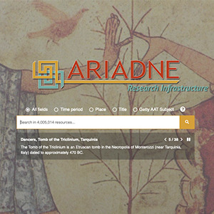
The ARIADNE Portal offers a central point of access to the archaeological resources made available from partner institutions throughout Europe. Behind the portal lie the ARIADNE registry and a set of services that are used to manage information about the datasets, collections, vocabularies, metadata schemas and mappings.
The ArCOA digital archive consists of a backend using a relational database for persistence, a browser-based interface for the synchronous recording and manipulation of data by a distributed workgroup, and a REST API service to expose interoperable data that will be queried by the project’s portal. The entire system is based on open-source technology. The conceptual model of the relational database consists of nine entities for the description of the objects, the collections to which they belong, the collectors who formed them, the institutions where they are currently hosted, the sites of origin of the pieces, the archival documents describing them, their images and 3D models, and the related bibliography.
Realizzato nell’ambito del progetto “Uomini & animali @ Tarquinia & Gravisca” (Progetto PRIN 2022) e rappresenta una soluzione all’avanguardia per la gestione, l’archiviazione e l’analisi dei dati provenienti dagli scavi archeologici: il sistema risponde all’esigenza di un approccio interdisciplinare e innovativo nell’indagine dei contesti caratterizzati da attività variegate e rituali come quelle attestate al ‘complesso monumentale’ di Tarquinia, ma anche nel sito di Gravisca. La piattaforma è stata progettata per integrare dati stratigrafici, informazioni sui reperti mobili e risultati provenienti da discipline scientifiche eterogenee (archeometria, antropologia, geoarcheologia, architettura, geofisica), offrendo strumenti avanzati come la generazione automatica dello schema del matrix di Harris e funzionalità di interrogazione visuale dei dati.
In Emilia-Romagna, il Segretariato Regionale e le Soprintendenze territorialmente competenti hanno sviluppato, a partire dal 2019, un Geodatabase dei siti oggetto di interventi e/o ritrovamenti archeologici (ArcheoDB) che viene aggiornato in tempo reale ed è pienamente interoperabile con il Geoportale Nazionale per l’Archeologia (GNA). Oggi questo strumento è adottato per la raccolta sistematica dei dati archeologici sul territorio regionale. Le Soprintendenze sono costantemente impegnate, con il proprio personale e le risorse dedicate al progetto, nel recupero e perfezionamento dei dati d’archivio, messi a disposizione di professionisti, imprese e ricercatori, ad esempio per la redazione delle Valutazioni Preventive dell’Impatto Archeologico.
In Emilia-Romagna, il Segretariato Regionale e le Soprintendenze territorialmente competenti hanno sviluppato, a partire dal 2019, un Geodatabase dei siti oggetto di interventi e/o ritrovamenti archeologici (ArcheoDB) che viene aggiornato in tempo reale ed è pienamente interoperabile con il Geoportale Nazionale per l’Archeologia (GNA). Oggi questo strumento è adottato per la raccolta sistematica dei dati archeologici sul territorio regionale. Le Soprintendenze sono costantemente impegnate, con il proprio personale e le risorse dedicate al progetto, nel recupero e perfezionamento dei dati d’archivio, messi a disposizione di professionisti, imprese e ricercatori, ad esempio per la redazione delle Valutazioni Preventive dell’Impatto Archeologico.
Prodotto nato nell'ambito del progetto: TARKUNIA - Fonti letterarie antiche su Tarquinia.
Nel database Archeo-Text Search Engine ogni passo letterario, in greco o in latino è introdotto dalle informazioni necessarie a identificarlo (autore, opera, libro, capitolo…) ed è corredato della traduzione italiana, della datazione e di un eventuale commento. Per ogni testo inoltre sono state identificate alcune key-words.
ADS is the leading accredited repository in the UK for archaeology and historic environment data, with over 25 years of experience supporting research, learning and teaching with free, high quality and dependable digital resources.
An exhaustive digital Archaeological Atlas of Coptic Literature provides a new comprehensive perspective on the spread and development of Coptic literature and manuscript culture. This versatile tool allows detailed and focused research and correlation of chronological, regional and thematic data. It also illustrates the relationship between settlements uncovered by the archaeological and topographical investigations and intellectual activity revealed in manuscripts.
The Archaeological Atlas of Coptic Literature is based on a central web database will be continuously updated in the future. The database is composed of seven fundamental parts (entities), dedicated to Places, Manuscripts, Works, Authors, Titles, Colophons, and Collections. Each part addresses specific issues and follows its own methodological guidelines and descriptive protocols which are closely linked to each other in a network pattern that draws it strength from these links. The principal aim is to provide the literary and manuscript tradition with a sound archaeological and geographical context and vice-versa.
The Atlas gives full access to the main database and provides different types of search experience, from the easiest (and easy to perform) to the most refined and granular.
To help and guide users towards interesting research results some default search filters are prepared and made available, ready to be run and visualised. These “Saved queries” are available for single parts and for geographic data visualisation. The welcome page of the Atlas shows by default all Places that are related to Coptic Literary Manuscripts, and by disabling the filter in the left bar all recorded Places are shown. Amongst other products, PAThs presently includes:
- A complete classification of the Coptic manuscript tradition, by means of the attribution of stable identifiers for each manuscript (codicological unit), in order to have univocal coordinates of reference for the entirety of Coptic literary production. Such a classification can be progressively expanded as new manuscripts are discovered.
- A detailed codicological description of part of the codicological units (to be expanded progressively).
- A complete classification of Coptic literature, by means of the attribution of a Clavis Coptica (CC) entry for each work and each title, and of a stable identifier for each colophon.
- A complete census of the relevant places, including sites where individual manuscripts (for instance codices buried with a body, as a funerary kit) or entire ‘collections’ (for example a monastery library) have been found; major Late Antique and Medieval archaeological sites, as known from published reports; other places of political, religious, and cultural significance (like episcopal sees), even when they have left no specific physical trace or evidence.
- A census, edition, and translation of Coptic titles.
- A census, edition, and translation of Coptic colophons.
- A classification of book formats, writing supports and other relevant codicological features of the manuscripts, in relation to the texts that they transmit.
La mappatura delle evidenze archeologiche rappresenta l’azione preliminare per la comprensione del popolamento.
Il progetto ha previsto una prima raccolta di tutte le informazioni disponibili per l’elaborazione di un GIS correlato di tabelle attribuiti dedicate ai siti e ai campioni delle analisi archeometriche.
Per questo scopo sono stati consultati gli archivi storici del territorio (Archivio Topografico del Museo Civico Archeologico di Bologna; Archivio Topografico e Storico presso la Soprintendenza Archeologia, belle arti e paesaggio per la città metropolitana di Bologna e le province di Modena, Reggio Emilia e Ferrara), integrati con la documentazione edita negli anni.
Il cuore del progetto APENNINESCAPE è un database georeferenziato che integra dati archeologici, geomorfologici e ambientali. Realizzato con tecnologie open-source, il database raccoglie informazioni su siti, risorse naturali e percorsi storici, offrendo una piattaforma unica per l'analisi e la condivisione.
Grazie a strumenti GIS avanzati, il database supporta modelli predittivi per identificare nuovi insediamenti e tracciare antiche rotte transappenniniche. Accessibile a diversi livelli, dai ricercatori agli stakeholder locali, rappresenta uno strumento fondamentale per valorizzare il patrimonio territoriale e promuovere la conoscenza del passato.
The Anglo-Saxon Kent Electronic Database (ASKED) is a collaboratively built research tool, developed to facilitate the doctoral research of two students of the UCL Institute of Archaeology: Stuart Brookes, investigating state formation in Anglo-Saxon East Kent, and Sue Harrington, examining aspects of gender and craft production in early Anglo-Saxon England with particular reference to the early kingdom of Kent. The aim of ASKED was to enumerate all those individuals within eastern Kent for the period AD 400-750 for whom there is archaeological burial evidence. The project produced a comprehensive electronic register of the archaeological remains and material culture of these populations, thus providing for the first time a searchable corpus of this information. The database lists 52 cemeteries from eastern Kent, as well as the inhumations and objects interred within. Information for these burials is derived from published reports and the inspection of museum archival material.