

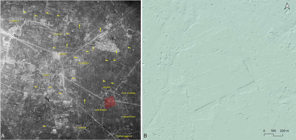
Atella and its territory (case study 1) as seen in a historical aerial photograph (RAF 1945) annotated by G. Scardozzi (A) and in the DTM with a 1-meter ground resolution derived from LiDAR scanning acquired by the Ministry of the Environment of Italy
Position: 4537 (10 views)