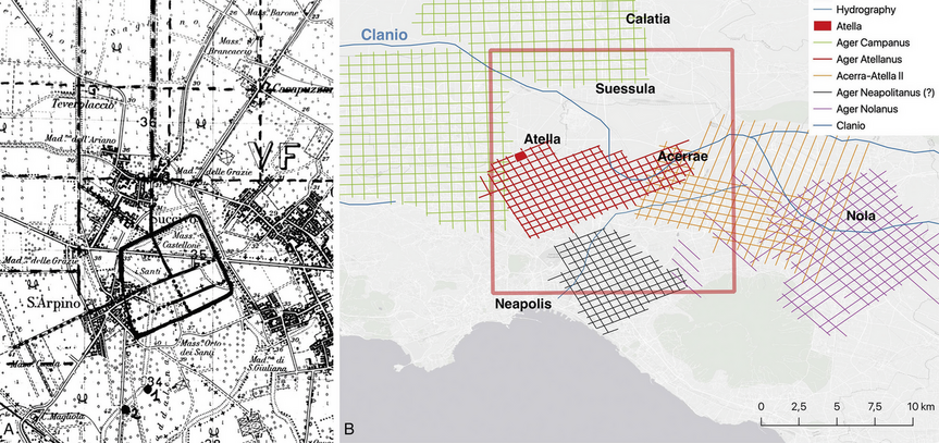
The site of Atella and its hypothesized cadastral layout (case study 1) plotted on a 1:25,000 scale topographic map (A) and within the broader context of Campania region (B)
Title
The site of Atella and its hypothesized cadastral layout (case study 1) plotted on a 1:25,000 scale topographic map (A) and within the broader context of Campania region (B)