

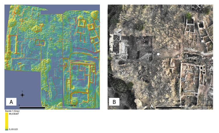
a) Slope map highlighting identified anomalies corresponding to the profiles of specific rooms (the values represent the slope degree); b) drone orthophoto of the SW area of the Cencelle site taken in September 2020
Part of ‘Open’ architecture of UAVIMALS prototype and its archaeological use
Position: 3143 (8 views)