

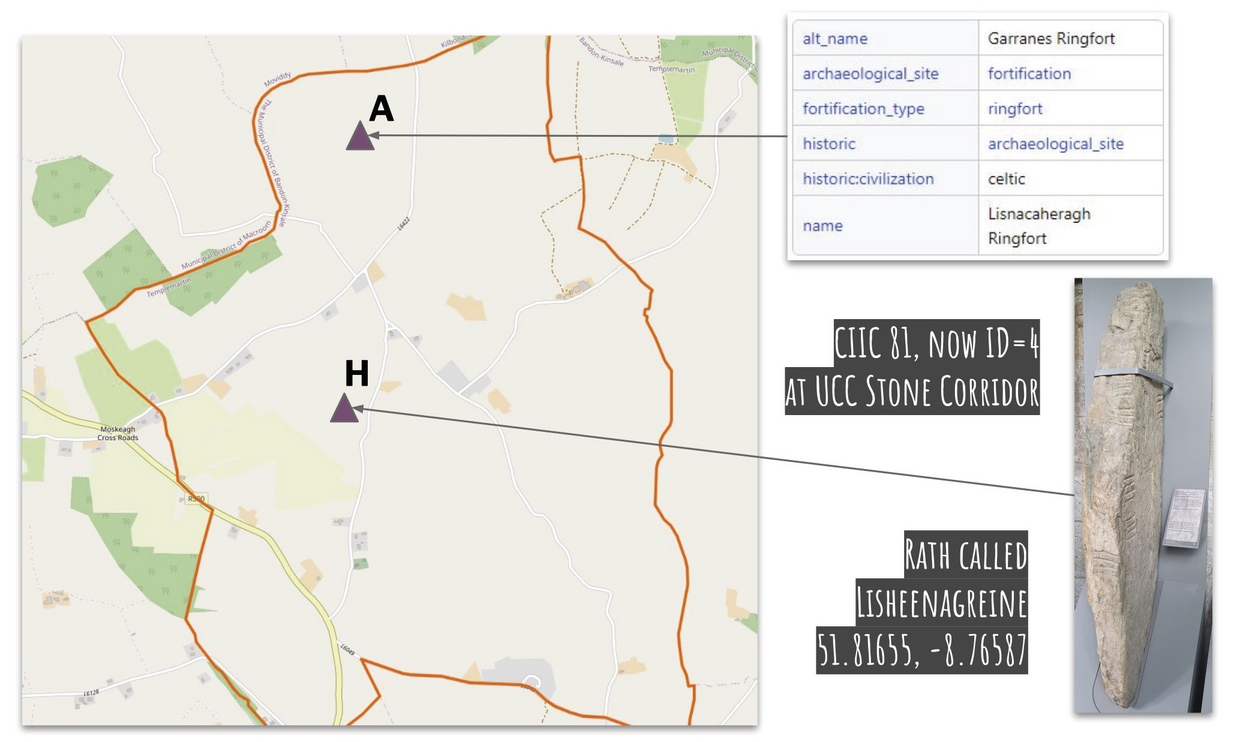
Left: current OSM map with the OSM Relation 6168494 (see A) and the possible position of CIIC 81 (see H), geo-referenced based on the path network using the plan of the location of (A) Lisnacaheragh Ringfort and (H) Lisheennagreine (from Ó Ríordáin, Ryan 1941, 80); right-top: description of OSM Way 562702954; right-bottom: Ogham Stone CIIC 81 in the UCC Stone Corridor, as well as the possible location coordinate (left/right-top: Open Street Map Contributors, ODbL, via OSM; right-bottom: F. Thiery)
Part of Dealing with doubts: site georeferencing in archaeology and in the geosciences
Position: 2047 (13 views)