

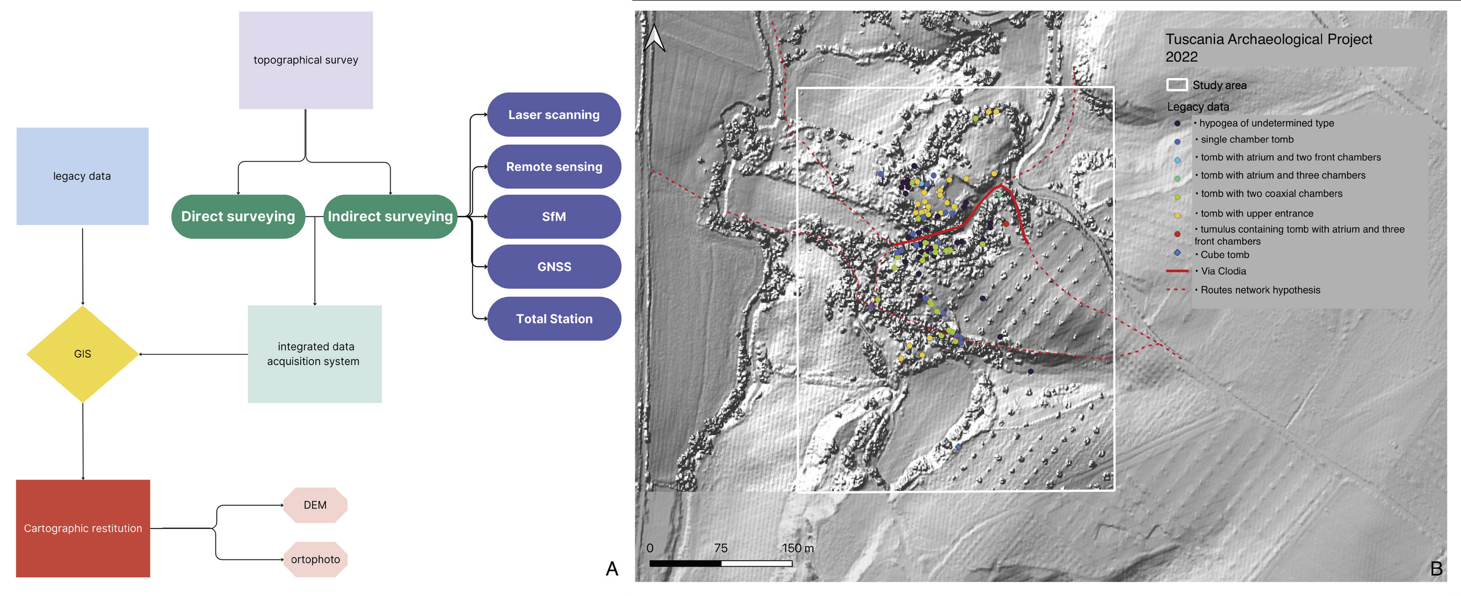
A) Diagram of the topographic data integration process; B) Sasso Pinzuto-Tuscania (in white): archaeological legacy data available for the site pletted on a topographic basis obtained from a 1 m LiDAR Composite DTM (2013, Ministero dell’Ambiente e della Tutela del territorio e del mare) in the GIS created for the project
Position: 3470 (11 views)