The coast ot Apulia includes a number of stretches of coastal cliffs which, due to their geo-structural character and the relentless wave action of the sea, reveal clear phenomena of mass movement. The cliffs of Porto Miggiano (south-est Apulia) are considered in this work their conditions of stability are evaluated in relation to the geo-mechanical characteristics of the rock outcrops and to the effective state of mass movement found. The stratigraphic sequence of the area is formed by a paleocenic carbonatic basement known as the Formation of Castro Limestone, on which in transgression calcarenitic rocks are found known in the literatures as «Calcarenites of Salento», A detailed study of the calcarenitic lithofacies has made it possible to sub divide the calcarenitic formation into two parts. The lower, oft Calabrian origin, is formed by calcarenites in which intercalations of marly-clayey silts are present towars the top. The upper part, of tyrrhenian origin, is formed by cross bedded calcarenites which rest on silts below with marked angular discordance. The analysis of the tectonic and geo-structural character of the area made it possible to hypothesize the presence of two direct faults running respectively NW-SE an d NNE-SSW, which can be traced to Plio-quaternary neo-tectonics, and also to define the geometry of the discontinuity families which affect the rock mass. The determination of the physical parameters of the pleistocenic calcarenites allows some hypotheses to be made about the environment of formation of the silty partss; while, in agreement with what emerges from the geo-physical survey, the parameters ot mechanical resistence obtained show the poor quality of the rock. The state of mass movement found on the stretch of coast studied is almost exelusively confined to the tyrrhenian calcarenites and is due to the mobilization phenomena of falls toppling, breaks along newly formed shear planes and sliding of wedges. The verification ot sliding and toppling stability carried out with the graphic methods proposed by J.T. Markland, E. Hoek & J.W. Bray, and R.E. Goodman, have given safety factor levels generally below the limit value of Fs = 1, thus confirming the correspondence between the instability deduced from the calculation and that actually found in situ. Finally, the comparison of the safety factors obtained shows the substantial equivalence between the verification methods employed.
Nuova Edizione – Venticinque anni di archeologia globale è una raccolta di pubblicazioni che l’autore ha realizzato, spesso in collaborazione con altri ricercatori, nell’ambito dell’Istituto di Storia della Cultura Materiale (ISCUM), del Dipartimento di Scienza della Terra e della Facoltà di Architettura dell’Università di Genova. I lavori sono stati selezionati e raggruppati in base ai seguenti temi: 1) Archeologia dell’urbanistica; 2) Insediamenti abbandonati; 3) Caratteri costruttivi dell’edilizia storica; Archeologia delle tecniche produttive; 5) Archeometria. La divisione in cinque temi principali si è resa necessaria per ragioni editoriali, tenuto conto anche dei raggruppamenti didattici. Ciò non toglie che uno degli scopi della raccolta sia anche un invito ad osservare i manufatti e a pensare contemporaneamente con discipline diverse, senza cadere nei pericoli della tuttologia. Se è necessaria infatti l’indipendenza di ciascuna disciplina, per la specializzazione ed il rigore che richiede l’uso dei diversi strumenti di ricerca, è anche utile per l’archeologia globale poter usare molti strumenti onde superare i dubbi frequenti, e allargare le conoscenze oggettive.
Is the customary word "data" a good name for archaeological records and facts? "Data" means the things that are "given," but archaeological observations and facts are never given at all. Rather, they are captured by the researcher, who seeks to grasp from the material record the essentials of some complex and little-known phenomenon, often remote in time and usually ambiguous in material expression. We should prefer to use the better word "capta," the things that have been captured, and to realize that this word captures the essence of what we do.
The volume of ceramic vessels provides several information about their use. However, due to the fragmentation of pottery coming from settlement sites, data concerning the volume are rarely published. The first goal of this paper is presenting a new method to calculate the volume starting from the archaeological drawings. The dataset could be extended with a predictive regression analysis. The sample analyzed involves cups and bowls found on the top of Monte Cimino (Viterbo-Italy), a settlement and cult site dated to the Final Bronze Age (ca. 1150-950/925 BC).
Si moltiplica l’offerta culturale di iniziative open cource e commerciali per fornire ai musei strumenti per creare mondi digitali. Come racconta ArcheoVirtual
Canals in the Neo-Assyrian Rural Landscape: A View from the Habur and Middle Euphrates, in H. Kuehne (Hrsg,), Umwelt und Subsistenz der assyrischen Stadt Dur-Katlimmu am Unteren Habur (=BATSH 8), Wiesbaden 2008, 181-187
Quantitative, attribute-based analyses of stone tools (lithics) have been frequently used to facilitate large-scale comparative studies, attempt to mitigate problems of assemblage completeness and address interpretations of the co-occurrence of unrelated technological processes. However, a major barrier to the widespread acceptance of such methods has been the lack of quantified experiments that can be externally validated by theoretically distinct approaches in order to guide analysis and confidence in results. Given that quantitative, attribute-based studies now underpin several major interpretations of the archaeological record, the requirement to test the accuracy of such methods has become critical. In this paper, we test the utility of 31 commonly used flake attribute measurements for identifying discrete reduction trajectories through three refitted lithic sets from the Middle Palaeolithic open-air site of Le Pucheuil, in northern France. The experiment had three aims: (1) to determine which, if any, attribute measurements could be used to separate individual refitted sets, (2) to determine whether variability inherent in the assemblage was primarily driven by different reduction trajectories, as represented by the refitted sets, or other factors, and (3) to determine which multivariate tests were most suitable for these analyses. In order to test the sensitivity of the sample, we ran all analyses twice, the first time with all the available lithics pertaining to each refitted set and the second time with randomly generated 75 % subsamples of each set. All results revealed the consistent accuracy of 16 attribute measurements in quadratic and linear discriminant analyses, principal component analyses and dissimilarity matrices. These results therefore provide the first quantified attribute formula for comparative analyses of Levallois reduction methods and a basis from which further experiments testing core and retouch attributes may be conducted.
Weed management is a crucial issue in agriculture, resulting in environmental in-field and off-field impacts. Within Agriculture 4.0, adoption of UASs combined with spatially explicit approaches may drastically reduce doses of herbicides, increasing sustainability in weed management. However, Agriculture 4.0 technologies are barely adopted in small-medium size farms. Recently, small and low-cost UASs, together with open-source software packages, may represent a low-cost spatially explicit system to map weed distribution in crop fields. The general aim is to map weed distribution by a low-cost UASs and a replicable workflow, completely based on open GIS software and algorithms: OpenDroneMap, QGIS, SAGA and OpenCV classification algorithms. Specific objectives are: (i) testing a low-cost UAS for weed mapping; (ii) assessing open-source packages for semi-automatic weed classification; (iii) performing a sustainable management scenario by prescription maps. Results showed high performances along the whole process: in orthomosaic generation at very high spatial resolution (0.01 m/pixel), in testing weed detection (Matthews Correlation Coefficient: 0.67–0.74), and in the production of prescription maps, reducing herbicide treatment to only 3.47% of the entire field. This study reveals the feasibility of low-cost UASs combined with open-source software, enabling a spatially explicit approach for weed management in small-medium size farmlands.
A mosquito-infested and swampy plain lying north of the city walls, Rome's Campus Martius, or Field of Mars, was used for much of the period of the Republic as a military training ground and as a site for celebratory rituals and occasional political assemblies. Initially punctuated with temples vowed by victorious generals, during the imperial era it became filled with extraordinary baths, theatres, porticoes, aqueducts, and other structures – many of which were architectural firsts for the capitol. This book explores the myriad factors that contributed to the transformation of the Campus Martius from an occasionally visited space to a crowded center of daily activity. It presents a case study of the repurposing of urban landscape in the Roman world and explores how existing topographical features that fit well with the Republic's needs ultimately attracted architecture that forever transformed those features but still resonated with the area's original military and ceremonial traditions.
Das Marsfeld, obwohl am Rande der antiken Stadt gelegen, gilt besonders aufgrund seiner öffentlich-repräsentativen Bebauung als ein wesentliches Zentrum der Stadt Rom. Von der Republik bis in die Prinzipatszeit sind einige der bedeutendsten Monumente und Bauten der Tibermetropole hier gestiftet worden, die auch als Stellvertreter für den jeweiligen politischen Zeitgeist verstanden werden können. Das Areal bietet sich also hervorragend für eine Untersuchung zur urbanistischen Entwicklung über einen langen Zeitraum hinweg an. Thema dieses Buches ist insofern die Untersuchung der Bebauung des Feldes von den Anfängen in republikanischer Zeit bis in die mittlere Kaiserzeit, wobei besonders die jeweiligen funktionalen Aspekte zu unterschiedlichen Zeiten analysiert werden. Dabei lassen sich mehrere Schwerpunkte in der Architektur und den antiken literarischen Quellen – z.B. der sakral oder der militärische – langfristig verfolgen. Gleichzeitig wird die dauerhafte Entwicklung des Campus thematisiert, wobei es um die Voraussetzungen für die Bebauung des Gebietes, die Entstehung und Übernahme neuer Gebäudeformen, die Achsensysteme und die infrastrukturelle Erschließung geht.
How did the medieval bell towers was constructed? A view on bells and bell towers in the High Middle Ages through the written sources. PROVIDED FOR NON-COMMERCIAL RESEARCH AND EDUCATIONAL USE ONLY. NOT FOR REPRODUCTION OR DISTRIBUTION OR COMMERCIAL
Questa dettagliata relazione presenta le scoperte di una campagna di scavi archeologici presso Monte Abbatone a Cerveteri in Italia. Offrendo uno sguardo unico sulla vita degli antichi etruschi che hanno abitato quest'area, il libro è un must per gli appassionati di archeologia e della storia dell'Italia antica.This work has been selected by scholars as being culturally important, and is part of the knowledge base of civilization as we know it.This work is in the "public domain in the United States of America, and possibly other nations. Within the United States, you may freely copy and distribute this work, as no entity (individual or corporate) has a copyright on the body of the work.Scholars believe, and we concur, that this work is important enough to be preserved, reproduced, and made generally available to the public. We appreciate your support of the preservation process, and thank you for being an important part of keeping this knowledge alive and relevant.
The use of action cameras for photogrammetry purposes is not widespread due to the fact that until recently the images provided by the sensors, using either still or video capture mode, were not big enough to perform and provide the appropriate analysis with the necessary photogrammetric accuracy. However, several manufacturers have recently produced and released new lightweight devices which are: (a) easy to handle, (b) capable of performing under extreme conditions and more importantly (c) able to provide both still images and video sequences of high resolution. In order to be able to use the sensor of action cameras we must apply a careful and reliable self-calibration prior to the use of any photogrammetric procedure, a relatively difficult scenario because of the short focal length of the camera and its wide angle lens that is used to obtain the maximum possible resolution of images. Special software, using functions of the OpenCV library, has been created to perform both the calibration and the production of undistorted scenes for each one of the still and video image capturing mode of a novel action camera, the GoPro Hero 3 camera that can provide still images up to 12 Mp and video up 8 Mp resolution.
The 3D models produced from the photogrammetrical documentation of cargos of marble of Roman period, lying along the seabed of Calabria, Sicily and Sardinia, are used to reconstruct the minimun dimensions of the ships carrying these special transportations. Since the hull remains in these sites are very poor, the 3D reconstruction of the cargo is the only possibility to estimate the tonnage and size of these vessels. After a reconstruction of the original assemblage of blocks and columns of marble, the 3D model is used to calculate the hydrostatic characteristics of the ship. Comparisons of these ship-models with data from the two known big onerariae, carrying amphoras are made.
Archaeological publications raise problems of many sorts, currently discussed in connection with computer networks and other technologies. One of them, however, seems somewhat neglected, namely the fact that we are mostly unable to read more than a fraction of the articles and books published in our respective fields of research. The substitution of electronic to printed publications does not fully meet that challenge. Complementary measures are needed, taking into account an acknowledged reality: our works are for the most part consulted, not read. The schematisation of archaeological constructs developed in the logicist perspective is meant to facilitate consultations; it is related to the computational paradigm of the information age. As such, however, it fails to fulfil one of the functions of historical works, associated with the narrative mode of thought and discourse. This paper advocates a parallel development of the two genres in archaeology, one through electronic publications of a radically new form, the other through printed works explicitly conceived as literary versions or expansions of the former.
The paper identifies a number of possible developments in archaeology in the ’90s. The epigenetic panorama is seen as evolving in three major directions, which are termed, ironically, “pie archaeology”, “ambush archaeology” and “glove archaeology”. This latter direction, an emerging but still undefined area at the critical interface between archaeological theory and Artificial Intelligence, is identified as the most promising for the near future, particularly since it may unblock the impasse which hinders theoretical development. This “pipe-dream” is discussed with reference to the Anglo-Italian field-survey project, the “Progetto Alto-Medio Polesine-Basso Veronese”, where an attempt is being made to put theory into practice.
The authors present the “CAIE” project, carried out at the Istituto per l'archeologia etrusco-italica of the Italian CNR. The aim of the project is the computerisation of the Thesaurus Linguae Etruscae, with the use of an Information Retrieval System, and the association between texts and archaeological and epigraphical information, such as place and way of finding, support object, technical characteristics, chronology and bibliographical references. The choice of the program FUL/TEXT, implemented for IBM PC, is related to the facility of organising the data both in fixed fields, useful for recording archaeological and epigraphical information, and in free format, useful for recording texts. A personalisation of the program was also implemented, above all for solving the problems presented by the Etruscan language. Data bank consultation is foreseen and will allow interrogations to be made also by unspecialised users.
This volume brings together unpublished Italian and Albanian archaeological reports and new archaeological studies from recent fieldwork that throw new light on the archaeology and history of the Pavllas River Valley, the Mediterranean alluvial plain in the territory of Butrint, ancient Buthrotum, in southwestern Albania. It gives prominence for the first time to two important sites, Kalivo and Çuka e Aitoit, which are here reinterpreted and shown to have played major roles in the early history of Butrint as it evolved in the later first millennium BC to emerge as the key city of Chaonia in Epirus. Butrint 7 also presents the full excavation report of the Late Bronze Age and Hellenistic fortified site of Mursi, in addition to other Butrint Foundation surveys and excavations in the hinterland of Butrint, including the Roman villa maritima at Diaporit, the villa suburbana on the Vrina Plain, and Roman sites on Alinura Bay and at the Customs House, as well as new surveys of the early modern Triangular Fortress and a survey to locate the lost Venetian village of Zarópulo. The volume also features a new study of the Hellenistic bronze statuette of Pan found on Mount Mile and of his sanctuary at Butrint. The volume concludes with a comprehensive reassessment of the Pavllas River Valley in relation to Butrint, from the Palaeolithic to the modern eras, examining how dominion, territory, environment and the &;corrupting sea&; reshaped Butrint and its fluvial corridor diachronically and particularly brought profound territorial, economic and social alterations under the Roman Empire.
The detection of ancient palaeo-surfaces and horizons is feasible with various pedological methods. The aim of the biomorph analysis is to provide data on the properties of ancient surfaces by locating the palaeo-horizons and describing their vegetational patterns. While conducting the kurgan research, we have often faced the problem of the precise description and localisation of palaeo-horizons within the stratigraphy of the formations. The biomorph analysis provides data in palaeoecological research through the examination of "phyto" and "zoo" microremains. The so-called "multiple biomorph analysis" works both with organic (spores, pollen, charcoal, detritus) and mineral (inorganic) (phytoliths, spicules of sponges, diatoms) biogenic microparticles that can be recovered from soil/sediment samples. One aim of the quantitative analysis of these particles is the identification of the biomorph content in the relevant fractions of the cultural layers and genetic soil horizons and the graphical display throughout the examined cross-section. The present paper is aimed at introducing the utilisation of the quantitative biomorph analysis in palaeoecology and environmental archaeology.
The paper aims to explain the analytical method used to virtually recreate the houses of the Etruscan city of Marzabotto. As stated in the title, the starting point of the process was the analysis conducted on the tangible archaeological evidence of building materials; these latter were fully integrated with data provided by the ancient sources and the latest technology. Next, the problems and the solutions adopted in order to recreate the houses are presented. In the last section the criteria used for the visual restitution of the unexcavated context of the ancient city are explained.
We discuss the evolution and state-of-the-art of the use of Building Information Modelling (BIM) in the field of culture heritage documentation. BIM is a hot theme involving different characteristics including principles, technology, even privacy rights for the cultural heritage objects. Modern documentation needs identified the potential of BIM in the recent years. Many architects, archaeologists, conservationists, engineers regard BIM as a disruptive force, changing the way professionals can document and manage a cultural heritage structure. The latest years, there are many developments in the BIM field while the developed technology and methods challenged the cultural heritage community in the documentation framework. In this review article, following a brief historic background for the BIM, we review the recent developments focusing in the cultural heritage documentation perspective.
Building Information Modeling is considered by the scientific literature as an emerging trend in the architectural documentation scenario, as it is basically a digital representation of physical and functional features of facilities, serving as a shared knowledge resource during their whole life cycle. BIM is actually a process (not a software, as someone indicated), in which different players act sharing data through digital models in a coordinated, consistent and always up to date workflow, in order to reach reliability and higher quality all over the construction process. This way BIM tools were originally meant to ease the design of new architectures, generated by parametric geometries connected through hierarchical relationships of “smart objects” (components self-aware of their identity and conscious of their interactions with each other). However, this approach can also be successfully applied to what already exists: TLS (Terrestrial Laser Scanning) or digital photogrammetry are supposed to be the first abstraction step in a methodology proposal intended as a scientific strategy in which BIM, relying on its own semantic splitting attitude and its topological structure, is explicitly used in representation of existing buildings belonging to the Cultural Heritage. Presenting some progresses in the development of a specific free Autodesk Revit plug-in, nicknamed GreenSpider after its capability to layout points in the digital domain as if they were nodes of an ideal cobweb, this paper examines how point clouds collected during high definition surveys can be processed with accuracy in a BIM environment, highlighting critical aspects and advantages deriving from the application of parametric techniques to the real world domain representation.
While BIM processes are established for new buildings, the majority of existing buildings is not maintained, refurbished or deconstructed with BIM yet. Promising benefits of efficient resource management motivate research to overcome uncertainties of building condition and deficient documentation prevalent in existing buildings. Due to rapid developments in BIM research, involved stakeholders demand a state-of-the-art overview of BIM implementation and research in existing buildings. This paper presents a review of over 180 recent publications on the topic. Results show scarce BIM implementation in existing buildings yet, due to challenges of (1) high modeling/conversion effort from captured building data into semantic BIM objects, (2) updating of information in BIM and (3) handling of uncertain data, objects and relations in BIM occurring in existing buildings. Despite fast developments and spreading standards, challenging research opportunities arise from process automation and BIM adaption to existing buildings' requirements.
BIM is often misinterpreted as REVIT as it is introduced as BIM by vendors. The e-book gives a thorough view of BIM including technology, process and people aspects through a lifecycle perspective.
This paper describes the case study of the damaged church of St. Francesco in the hamlet of Arquata del Tronto (Italy) that was struck by the earthquake in 2016. The municipality commissioned the research to support the preliminary design of the preservation plan. The first digitisation level has been started from the richness of surveying data acquired from static and dynamic terrestrial laser scanning (TLS), and photogrammetry, overcoming challenging constraints due to the scaffolding covering the surfaces. The geometric survey allowed authors to acquire massively geometric and material information supporting the three-dimensional (3D) volume stratigraphic and the creation of the Heritage Building Information Modelling (HBIM). The paper proposes a shift from the Geographic Information System (GIS)-based analysis of the materials toward spatial HBIM management. Building Archaeology is turned into HBIM 3D volume stratigraphy, overcoming the bidimensional (2D) surface mapping, in favour of a 3D understanding of direct and indirect sources. Material mapping is added to HBIM 3D volume stratigraphy, and each stratigraphic unit (SU) has its proprieties. The 3D volume stratigraphic database has been designed to collect the data on the unit detection at three levels (direct sources data collection, indirect data documentation, the relation among the BIM object elements). A common data environment (CDE) has been set up to share the 3D volume informative models that can be accessed, and all the information gathered. The knowledge transfer using the eXtended reality (XR) has been devoted to the citizen and tourist fruition, enhancing the comprehension of difficult concepts like the SUs to support a better critical 3D reconstruction. It includes the phases of construction across time-lapse documentation that validates related information within the building archaeology informative models leaving spaces to the uncertainty and documenting the relationship established so far thanks to the direct and indirect sources. The result obtained is a live digital twin that can be continuously updated, which justifies the costs and time demanding of HBIM despite 2D drawings.Highlights: • 3D survey and scan-to-HBIM process for the creation of a digital twin were oriented to the preliminary design of the preservation plan of the church of St. Francesco in Arquata del Tronto (Italy). • Stratigraphy is investigated and oriented towards a digitisation process to share different levels of knowledge through new forms of digital-sharing such as Common Data Environment (CDE) and cloud-based BIM platform. • eXtended reality (XR) is the final tool to reach new levels of communication and a wider audience characterised by experts in the construction sector and virtual and non-expert tourists.
Abandoned towns have long been recognised as one of the most important resources to understanding the development and decline of the urban environment. In Britain, the number of opportunities for studies into abandoned Roman towns is limited as most have continued in use until the present day. The Wroxeter Hinterland Project is currently engaged in research on the best-preserved deserted Roman town in Britain: Viroconium Cornoviorum, in Shropshire – modern Wroxeter. The approach has been to use a broad range of geophysical prospecting methods to elucidate the nature and density of occupation on the site. Standard geophysical techniques such as magnetometry and resistivity have been extensively deployed alongside the newer technologies of Ground-penetrating radar, multi-probe, continuous-reading automated resistivity, seismology and conductivity. Airborne survey is adding another dimension through multi-spectral scanning and conventional aerial photography, while sub-surface surveys are being hatched up with ground-truthing data collected through conventional survey methods. The results are being processed in the Project’s GIS database and will provide as full an insight into the nature of occupation at Wroxeter as is possible without further extensive excavation. It is intended that the results will be published in an atlas and will also be accessible via the World-Wide-Web.
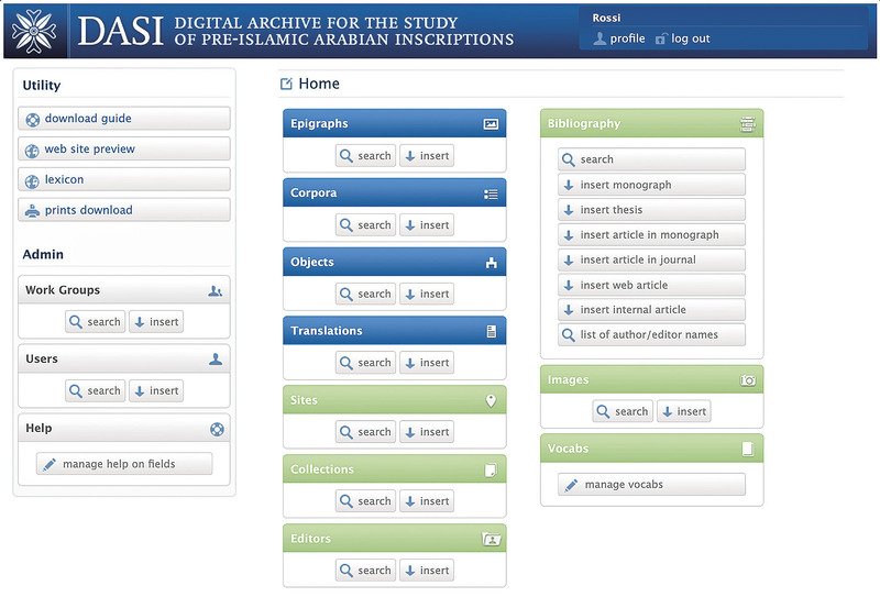
The Digital Archive for the Study of pre-Islamic Arabian Inscriptions (DASI, https://dasi. cnr.it/) currently provides open access to the digital editions of nearly 8800 ancient epigraphic texts from the Arabian Peninsula. After presenting an outline of DASI ecosystem through its 25-year history, this paper focuses on the recent enrichment of its data model, carried out within a pilot project of the E-RIHS infrastructure under the H2IOSC programme. The aim was to optimise DASI as an up-to-date tool for the digital critical edition of a broad spectrum of epigraphic sources from ancient Arabia, including graffiti, instrumenta inscripta, coins, and inscribed sticks, alongside ‘monumental’ inscriptions. Most of the interventions targeted the description of the visual aspect of writing and related contextual information, enhancing the digital representation of the material dimension of written heritage, which is often overlooked in philological studies. Ongoing work is targeting the FAIRification of DASI data, which has so far resulted in the sharing of an extensive bibliography of 1800 records through Zotero.
Weighing technology was invented around 3000 BCE between Mesopotamia and Egypt and became widely adopted in Western Eurasia within ∼2,000 y. For the first time in history, merchants could rely on an objective frame of reference to quantify economic value. The subsequent emergence of different weight systems goes hand in hand with the formation of a continental market. However, we still do not know how the technological transmission happened and why different weight systems emerged along the way. Here, we show that the diffusion of weighing technology can be explained as the result of merchants’ interaction and the emergence of primary weight systems as the outcome of the random propagation of error constrained by market self-regulation. We found that the statistical errors of early units between Mesopotamia and Europe overlap significantly. Our experiment with replica weights gives error figures that are consistent with the archaeological sample. We used these figures to develop a model simulating the formation of primary weight systems based on the random propagation of error over time from a single original unit. The simulation is consistent with the observed distribution of weight units. We demonstrate that the creation of the earliest weight systems is not consistent with a substantial intervention of political authorities. Our results urge a revaluation of the role of individual commercial initiatives in the formation of the first integrated market in Western Eurasia.
This new atlas of the ancient world illustrates the political, economic, social and cultural developments in the ancient Near East, the Mediterranean world, the Byzantine Empire, the Islamic world and the Holy Roman Empire from the 3rd millennium BC until the 15th century AD.
GIS tools in archaeology have become fundamental for professionals and researchers around the world. In recent years, the “3D revolution” has drastically changed archaeological practices and methods, including the use of GIS. This paper presents the results of a project aimed at building an integrated system for the management and study of archaeological data in 2D and 3D, connecting GIS to BIM. Building Information Modeling (BIM) is an innovative technology developed for architectural design and planning, and later adapted for cultural heritage and historic buildings (HBIM). More recently, it has been tested on archaeological sites. Some attempts have been made to connect landscape scale GIS projects with BIM models of individual buildings. However, these have not been applied specifically to archaeology thus far. Through the use of open-source software, a seamless workflow from data collection in GIS to 3D visualization and modeling in a native OpenBIM environment has been created. The paper illustrates this methodology with a case study about Altinum, a Roman city in northeastern Italy near Venice. The GIS component of the project manages the archaeological map of the city, while the OpenBIM application allows the virtual reconstruction of the sites. For the latter, the case of the ancient city-gate of Altinum is considered and explained.
Bronze is considered a key commodity during the European Bronze Age (BA, 2200-800BC). Recent studies have shown that, mostly during the Late Bronze Age (Late BA, 1300–800 BC), fragmented bronze objects were subjected to regulation consistent with a Pan-European weight system. This hypothesis is mostly based on statistical analyses of weights. In this article, we present the results of an experiment in which sickle replicas were broken up and the resulting fragments weighed and compared with examples attested from the BA. The purpose of the fragmentation was to obtain pieces complying with certain weight patterns similar to regularities observed in archaeological fragmented sickles and fragmented objects in general. Results of the fragmentation experiment have been compared with a statistical analysis of c. 1500 fragmented sickles from European BA hoards, concluding that archaeological and replica fragments share the same metrological characteristics. We suggest that rough weight-regulated fragmentation is possible even by persons with no metallurgical skill, and that both inaccurate and ‘unwanted’ fragments probably comprise the known archaeological examples. The article demonstrates that statistical analyses usually employed in similar research allow for detecting the existence of weight systems even in a dataset characterized by the significant presence of random values.
In this paper we provide an analytical insight on a specific form of bullion-currency. Through the comparison of the statistical properties of different samples of hacksilver and balance weights from various contexts of the Near Eastern Bronze Age, the study attempts to assess whether the weight values of bullion-currencies can be expected to comply with existing weight-standards. The results of the statistical analyses on a silver hoard from Ebla (Syria) strongly suggest that hacksilver in the Bronze Age Near East was shaped and/or fragmented in order to comply with the weight-systems that were in use in the trade networks where it circulated. The results also show the possibility to quantify the level of affinity between different weight-systems. The study is intended to provide a starting point for future research, aimed at the identification of different forms of bullion-currencies in pre- and protohistoric economies.
La carta geoarcheologica di Bologna è stata redatta con l'obiettivo di condividere le conoscenze acquisite in anni di studi sul sottosuolo di Bologna che conserva importanti testimonianze delle diverse fasi di sviluppo della città nella storia. Composta da cartografie e immagini relative al periodo romano e post–romano che interessano l’area urbana bolognese, la carta è frutto della collaborazione tra Servizio Geologico Sismico e dei Suoli della Regione Emilia-Romagna, Soprintendenza per i Beni Archeologici dell’Emilia-Romagna e Alma Mater Studiorum Università di Bologna. Sul fronte, due carte e una sezione illustrano l’andamento morfologico del piano romano e lo spessore dei sedimenti che lo ricoprono. Sul retro, ci si sofferma su concetti quali il suolo, gli ambienti deposizionali del passato e la distribuzione dei sedimenti che separano il piano romano da quello attuale.
The understanding and interpretation of ancient architecture, landscapes, and art has always been viewed through an iconographic lens—a cognitive process based on traditional practices in art history. But ancient people did not ascribe their visions on canvas, rather on hills, stones, and fields. Thus, Chris Tilley argues, the iconographic approach falls short of understanding how ancient people interacted with their imagery. A kinaesthetic approach, one that uses the full body and all the senses, can better approximate the meaning that these artifacts had for their makers and today’s viewers. The body intersects the landscape in a myriad of ways—through the effort to reach the image, the angles that one can use to view, the multiple senses required for interaction. Tilley outlines the choreographic basis of understanding ancient landscapes and art phenomenologically, and demonstrates the power of his thesis through examples of rock art and megalithic architecture in Norway, Ireland, and Sweden. This is a powerful new model from one of the leading contemporary theorists in archaeology.
L'archeologia dell'infanzia è un campo di ricerca molto attuale nel quadro internazionale degli studi dedicati all'antichità e negli anni più recenti ha visto una crescita considerevole anche grazie all'approccio interdisciplinare che arricchisce le indagini archeologiche di prospettive complementari, prime fra tutte quella dell'antropologia fisica e culturale. Il mondo infantile resta tuttavia molto difficile da analizzare per la scarsa visibilità che i bambini hanno in termini archeologici, a causa della fragilità dei resti ossei e della limitata evidenza sul piano sociale e culturale. Occorre allora adottare specifiche metodologie di indagine, capaci di fare emergere le tracce di una componente delle comunità antiche tanto significativa, quanto poco rappresentata a livello funerario. La attenta lettura contestuale dei dati riferibili ai bambini è il necessario presupposto per approdare a corrette ipotesi ricostruttive sulla percezione che ogni popolo aveva dell'infanzia. L'opera affronta il tema per la prima volta in modo sistematico e organico, mappando il fenomeno delle sepolture infantili nell'Italia del primo millennio a.C. Trenta saggi, scritti da circa sessanta studiosi, rendono questo volume la più aggiornata e completa raccolta di dati e di studi sull'archeologia dell'infanzia della penisola nell'età preromana. L'attenzione è rivolta non solo all'ambito sepolcrale, certamente il più ricco di informazioni, ma anche a quelli abitativo e santuariale molto meno noti, per ottenere un quadro conoscitivo il più possibile esteso e articolato. Dopo alcuni saggi che introducono alla riflessione teorica sviluppatasi attorno al tema, la prima parte dell'opera è dedicata ad un caso studio del mondo etrusco, oggetto di un recente progetto multidisciplinare; la seconda parte comprende numerosi contributi sull'Etruria, un territorio per il quale mancava finora una visione d'insieme su tutti i principali centri; la terza parte raccoglie saggi sulle popolazioni dell'Italia antica, offrendo uno straordinario sguardo sul mosaico di culture; infine un saggio finale, che delinea le coordinate culturali e antropologiche del fenomeno, valorizza la ricchezza e la complessità dell'opera. BIRTH costituisce il più completo strumento di conoscenza e di analisi del comportamento dei popoli dell'Italia antica nel trattamento funerario del bambino. Numerose appendici forniscono una dettagliata registrazione delle tombe infantili, base per ogni ricostruzione storica. L'opera è il primo passo di un percorso di studi destinato a proseguire, perché ancora molte sono le prospettive di indagine che l'archeologia dell'Italia preromana consente di sviluppare nell'ambito del più vivace dibattito scientifico internazionale sull'infanzia.
Rodent biogeographic studies are disproportionately scarce in Iran, however, they are an ideal system to understand drivers of biodiversity distributions in the country. The aims of the present research are to determine (i) the pattern of rodent richness across the country, (ii) quantify their elevational distribution patterns, and (iii) explore the underlying mechanisms. To reach these goals, an updated species list was compiled based on the latest taxonomic revisions, published until December 2021. We mapped all 76 rodent species distributions to develop the first map of rodent richness in Iran. We furthermore investigated their elevational distribution patterns in the following four geographic regions based on 100 m intervals; the Zagros Mountains, north of Alborz Mountains, south of Alborz and Kopet-Dagh mountains, and central and east mountains. North-east of Iran, Zagros Mountains, Alborz Mountains, and northwestern of Iran showed the highest richness and were identified as biodiversity hotspots of rodents in the country. This study highlights the importance of past climate change as the key driver of rodent richness in Iran. We showed that rodents’ elevational distribution patterns differ among geographic regions. Areas and elevational zones with the highest species richness should be prioritized for the conservation planning of rodents in Iran.
Bats are facing several threats like land-use change, habitat loss, overexploitation for food, mortality at wind energy turbine installations, disease, and climate change worldwide. Defining biodiversity of bat species can help conservation biologists to prioritize areas for bat conservation. In this study, we assembled distribution records of all bats of Iran to generate the first richness map of bats, as no richness map is available for bat species in the country. By constructing generalized linear models, we determined which historical and environmental factors drive the richness of bat species across the country. Results of richness mapping showed that Zagros Mountains host the highest number of species in Iran. We found that precipitation is the most influential variable in shaping bat richness in Iran by explaining 26% of variation in species richness. Topographic heterogeneity, with 19% of explained variance, was the second most important determinant of bat richness. We also estimated bat assemblage similarity among the biomes in the country. Temperate Grasslands, Savannas, and Shrublands biome was the most distinct biome based on bat assemblage. On the other hand, Montane Grasslands and Shrublands and Deserts and Xeric Shrublands were the most similar biomes based upon distributions of the bat species. Areas that were identified to have higher species diversity were regions with high priority for the conservation of bat biodiversity in the country. Temperate Grasslands, Savannas, and Shrublands, which host the most unique assemblage of bat species, have high importance for conservation. Therefore, to enhance the conservation of bats and maintain the important ecosystem services which they provide, we must have a clear knowledge of their richness and essential needs.
This study attempts to explore biogeographical patterns in vertebrate assemblages of the Czech Republic and to delineate faunal biogeographical regions of the country. We focused on native terrestrial species and first explored main gradients in the composition of their assemblages. The first gradient revealed by Principal Coordinate Analysis was best correlated with climatic variables, whereas the second gradient can be ascribed rather to longitude and to the associated habitat change. Using the spatially constrained clustering, the Czech Republic was divided into five cohesive regions and species above-average associated with these regions showed distinct distributions within the European continent. Delineated regions also significantly differed at least in three considered environmental variables. We provided clear evidence that species distribution data gathered by national mapping support main biogeographical patterns suggested by previously published expert-based classifications of the country. We also demonstrated that the fauna of the Czech Republic shows a biogeographical pattern very similar to that showed by natural habitats defined in terms of plant communities. This indicates that both fauna and flora of the Czech Republic yield to the same environmental forces and biogeographical processes such as spreading of faunistic and floristic elements from the adjacent Carpathian Mountains and the Pannonian Basin.
This paper proposes an analysis of degradation using a BIM design approach with the help of parameters, in order to populate the ad hoc model of information necessary for the analysis of the artefact. A building is chosen in the heart of Salerno, with modest historical relevance but great structural and geometric simplicity, so as to focus attention on the methods of representation of individual degradation. The strong point of the proposed methodology is the possibility to monitor the maintenance phases, offering information on materials and suppliers, operating, where necessary, structural and energy analyses. On the other hand, the presence of non-standard architectural elements, and therefore not traceable to predefined libraries, and the absence of parameters relating to degradation, represent some main problems faced in the case study examined. These problems are overcome through the implementation of a project database and software libraries, which can also be used for subsequent projects.
Modern cities require innovative urban design and development approaches that are efficiently tailored for neighborhood needs. To achieve this, decision makers must deal with information from both the micro (building asset) and the macro (neighborhood) levels, consequently deal with two very different information scopes and standards. This paper addresses this issue and introduces a new conceptual approach for developing a hybrid information infrastructure by integrating building design data, in the form of ifcXML, and 3D neighborhood models, in the form of CityGML. This paper uses examples from the operations and maintenance domain to explain the need for data integration to support decision makers at the neighborhood level by providing access to a wide range of detailed data, starting from the neighborhood scale and zooming in to a room in a building. The BIM-CityGML Data Integration (BCDI) approach that is introduced in this research satisfies both geometric and non-geometric (semantic) information queries in real time. This feature distinguishes BCDI significantly from related works that mainly focus on data conversion from one source to another. Furthermore, this work provides deep insights into the data structure of ifcXML and CityGML and discusses data mapping issues between these two common data standards.
In the built heritage context, BIM has shown difficulties in representing and managing the large and complex knowledge related to non-geometrical aspects of the heritage. Within this scope, this paper focuses on a domain-specific semantic-enrichment of BIM methodology, aimed at fulfilling semantic representation requirements of built heritage through Semantic Web technologies. To develop this semantic-enriched BIM approach, this research relies on the integration of a BIM environment with a knowledge base created through information ontologies. The result is knowledge base system - and a prototypal platform - that enhances semantic representation capabilities of BIM application to architectural heritage processes. It solves the issue of knowledge formalization in cultural heritage informative models, favouring a deeper comprehension and interpretation of all the building aspects. Its open structure allows future research to customize, scale and adapt the knowledge base different typologies of artefacts and heritage activities.