

Il GIS nella produzione delle carte dell'impatto archeologico: l'esempio di Pontecagnano
- Title
- Il GIS nella produzione delle carte dell'impatto archeologico: l'esempio di Pontecagnano
- Creator(s)
- D'Andrea, Andrea
- Date
- 1999
- Is Part Of
-
 Archeologia e Calcolatori
- Volume
- 10
- Pages
- 227–237
- Language
- ita
- Rights
- CC BY-NC-ND 4.0
- Abstract
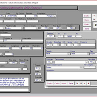
- Archaeological investigations over the last thirty years in Pontecagnano, an important Etruscan-Campanian site about 70 km south of Naples, have brought to light an interesting archaeological context consisting of a large ancient site and an extended cemetery with more then 7000 graves, dating from the 9th to the 4th century BC The need to acquire, analyse and display this rich collection of data has given rise to the project, addressed to the application of a vector GIS to handle archaeological records from funerary contexts. This work consists in the elaboration of a powerful cartographical database, including the spatial location of graves and their attribute data. In this way it is possible to create and display thematic maps in order to trace a reconstruction of the social organisation of the ancient settlement through the patterns of development of the cemetery. Meanwhile the exact recording of the excavated areas in the digital cartography, superimposed on the topography of the modern Pontecagnano, allows us to have a complete, updated view of the operations, in order to define a new townplan and infrastructural projects in the local area. The package chosen for the full integration of conventional archaeological data with maps is Mapinfo, a desktop mapping software in use in archaeological computing applications. The information has been organized into three tables: burial data, paleobiological remains and grave-goods. These tables are linked to the digital cartography, structured according to different layers representing the ancient levels of the graves and the topography of the modern town. The project, involving numerous public agencies with different institutional aims, is designed to offer a single tool responding to different needs: scientific research, territorial management, running of a museum, townplanning and informing the public.
- cited by
- Funerary archaeology and digital technologies: history and development of a successful cross-disciplinary approach
-
 Le necropoli di Pontecagnano: archivi e supporti digitali per la tutela e la ricerca a 25 anni dall’elaborazione del GIS
-
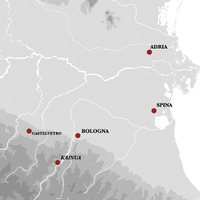 Archaeological data management and spatial analysis tools in the study of necropolises: case studies from Bologna and Spina (6th-3rd cent. BC)
Linked resources
Export
Position: 3346 (17 views)