This paper has been conceived in the context of the activities of the Joint Archaeological Mission of Sapienza University of Rome and the Albanian Institute of Archaeology in Çuka e Ajoit (Albania), and is aimed at providing a general overview and assessment on the historical geography of the Cestrine region, where Çuka e Ajtoit is located. The analysis of the written sources underlines the importance of the connection to the Trojan myth, that have determined in more than one case the toponymy of the area. This context is strictly related to the genealogical constructions that Chaonian, Thesprotian and Molossian élites have adopted since at least the 5th Cent. BCE. Possible connections to the Anatolian area have been hypothesized, yet archaeology still lacks to provide any support to them.
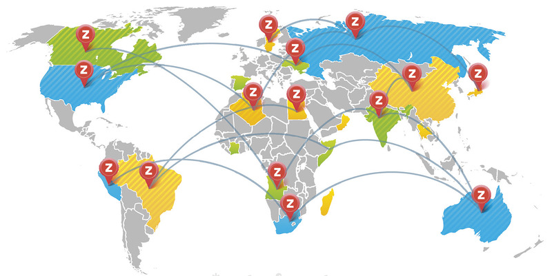
Zotero2map is a web application for sharing bibliographic data from various collaborators who want to share their bibliographic collections, using the Zotero software with the specificity of displaying and querying data also on a geographical map. With this tool the LAD: Laboratory of Digital Archeology at Sapienza (http://purl.org/lad) aims to facilitate the exchange of information relating to different historical and archaeological contexts, to speed up their retrieval and ensure constant updating of the data entered into the system. The webApp allows you to view and search for bibliographic data within an online map, using keywords (tags) that define the contents that are archived within the Zotero Libraries, which individual researchers already use for own scientific production. By simply clicking on the map it will therefore be possible to go back to the titles of the contributions, giving the possibility to individual users/researchers to always be updated on the scientific debate and on the publications concerning a certain area. The international vocation of the project presented is given not only by usability and open distribution, but also by the development of the cross-language functionality of keywords, a system that will allow the association of terms related to the same research topic but treated in different languages. The use of shared, multilingual dictionaries will allow not only to break down language barriers, but also to define an articulated taxonomy of relationships between the terms used. Individual researchers therefore do not have to adapt to pre-established vocabularies, but are invited to align their taxonomy with the shared one, making use of simple but powerful ontologies, such as SKOS or FOAF. Currently the software has been used on the specific case of Caonia, Northern Epirus.
Zotero: A Guide for Librarians, Researchers, and Educators is the first book-length treatment of this powerful research tool developed by the Center for History and New Media at George Mason University (VA). This book is written for Zotero end users, librarians and teachers. Part One introduces Zotero and presents it in the context of bibliography managers and open source software, Part Two explains in detail how to use the software in research and writing, and Part Three provides information for those who teach and support Zotero, with instructional best practices, examples, support tips and advanced techniques. "Puckett draws on his deep understanding of Zotero's technology to provide clear, concise guidelines and tips for beginners and experts alike. As a bonus, he convincingly argues why you -- yes, you -- need to be using research software and why Zotero is the best choice." says Sean Takats, co-director of Zotero, Assistant Professor of History at George Mason University and Director of Research Projects at the Center for History and New Media. A perfect guidebook to a robust open access research tool that allows the user to manage all aspects of bibliographic data, Zotero: A Guide for Librarians, Researchers, and Educators is essential for librarians and teaching faculty alike. Due to the clarity of explanation and the depth of application, its usefulness extends to undergraduate and graduate students as well.
Fixed an annoying bug that prevented the opening of resources on disk using default applications (i.e. images or PDF) Added support to recognise and open urls that are instead web urls (i.e. www.indianajonesrules.org) Added automatic population of paradata nodes from the files stored in the DosCo Added advanced section in the DosCo box Added function to export a csv with the metrics of the proxies (volume, surface, etc.) support for Blender 4 minor bug fixes
Virtual museum systems, based on different X-reality technologies, has begun to spread, as they represent decisive tools to promote exhibitions and reaching out to audiences. Although budgetary considerations have so far limited the choice of technologies a wide range of possible technological options are available today at low cost. This paper provides the results of an empirical study, with the aim to determine the most appropriate technologies to satisfy the visitors’ expectation and maximise their likelihood to repeat and recommend the experience. The study focuses on the comparison of the performance of five VM systems for visualise digital reproduction of archaeological finds, based on different technologies (i.e., PC desktop, holographic display, 3D stereoscopic projection, head mounted display and mobile Augmented Reality). The results provide useful insight for the development of VM systems, in order to maximize the visitor experience in terms of presence and ability to activate an experience economy perspective.
Over nearly four decades the Beazley Archive has developed from a personal archive, whose origins were rooted in 19th century classical scholarship, to a state-of-the-art electronic resource that can be used anywhere, at any time by anyone. The challenges along the way are noted and the ways they were met, in the hope of inspiring others to persevere. The first decade was "organisational", the second saw the adoption of ICT, the third was dominated by participation in EU R and D projects in telecommunications, and the fourth by the Vision of CLAROS - Classical Art Research Online Services. Since this lecture was given in autumn 2008 the CLAROS Vision has become a reality: by August 2009 more than two million records and images were integrated virtually using CIDOC-CRM. By adopting an ISO programme developed under the aegis of UNESCO for ICOM, the International Council of Museums, and by enhancing it with Open Source software, CLAROS offers a platform that any museum or research institute with digital assets can use free of charge for the public benefit. As the Beazley Archive approaches its fifth decade, it looks forward to collaborating for the advancement of scholarship and dissemination of results to the global community.
This article offers a summary of the Oxford University's Beazley Archive of Classical Archaeology and Art work since 1999 (for the period 1988 to 1999 see the tenth volume of this journal). The most important developments have been the migration of all of the Archive's databases and educational programmes on to the web (www.beazley.ox.ac.uk); the diversification of materials studied and methods of presentation; the imminent amalgamation of more than twenty databases into one searchable master dataset. This five-year summary is divided into three parts: the first part relates to the content and presentation of the Beazley Archive, with particular reference to the Pottery Database and the recent three-year project to digitise the CVA volumes for the web, which was granted to the Beazley Archive by the Union Académique Internationale; the second part relates to the technical structure of the datasets, storage and back up facilities and the third part relates to the nature and extent of the Archive's electronic assets and their relation to others in the University of Oxford.
How do archaeologists make knowledge? Debates in the latter half of the twentieth century revolved around broad, abstract philosophies and theories such as positivism and hermeneutics which have all but vanished today. By contrast, in recent years there has been a great deal of attention given to more concrete, practice-based study, such as fieldwork. But where one was too abstract, the other has become too descriptive and commonly evades issues of epistemic judgement.Writing the Past attempts to reintroduce a normative dimension to knowledge practices in archaeology, especially in relation to archaeological practice further down the ‘assembly line’ in the production of published texts, where archaeological knowledge becomes most stabilized and is widely disseminated. By exploring the composition of texts in archaeology and the relation between their structural, performative characteristics and key epistemic virtues, this book aims to move debate in both knowledge and writing practices in a new direction.Although this book will be of particular interest to archaeologists, the argument offered has relevance for all academic disciplines concerned with how knowledge production and textual composition intertwine.
UNESCO World Heritage sites are places of outstanding significance and often key sources of information that influence how people interact with the past today. The process of inscription on the UNESCO list is complicated and intersects with political and commercial controversies. But how well are these controversies known to the public? Wikipedia pages on these sites offer a unique dataset for insights into public understanding of heritage controversies. The unique technicity of Wikipedia, with its bot ecosystem and editing mechanics, shapes how knowledge about cultural heritage is constructed and how controversies are negotiated and communicated. In this article, we investigate the patterns of production, consumption, and spatial and temporal distributions of Wikipedia pages for World Heritage cultural sites. We find that Wikipedia provides a distinctive context for investigating how people experience and relate to the past in the present. The agency of participants is highly constrained, but distinctive, behind-the-scenes expressions of cultural heritage activism are evident. Concerns about state-like actors, violence and destruction, deal-making, etc. in the World Heritage inscription process are present, but rare on Wikipedia’s World Heritage pages. Instead, hyper-local and process issues dominate controversies on Wikipedia. We describe how this kind of research, drawing on Big Data and data science methods, contributes to digital heritage studies and also reveals its limitations.
This chapter discusses the spatial clustering of crafts in Roman cities. It starts from two modern examples of urban economic clustering, and then goes on to analyse three cases of clustering that are identifiable in the archaeological record, discussing evidence from Pompeii, Timgad, and Silchester, before assessing the evidence for clustering in texts. The chapter argues that clustering was a common phenomenon in Roman cities, and that work on contemporary clustering suggests this was essentially due to landlords—the elite— allowing the market to do its work, as this served their social and economic interests.
The purpose of this study is the analysis of the potential of Wikipedia as a key tool for the dissemination of information (Pentzold et al 2017) on Unesco World Culture Heritage from a multilingual perspective. This study proposes a framework that allows us to identify in what way a Unesco World Heritage asset is well represented in Wikipedia to favour its dissemination. Design and methodology– An empirical study was carried out on the Wikipedia entries relating to World Culture Heritage Assets identified by Unesco in Spain. Descriptive statistics were applied to describe structural differences. Wikipedia articles were researched taking into account aspects such as presence on the encyclopaedia, authority and accessibility Finally this study sets out a checklist (García-Santiago & Olvera-Lobo, 2017), which allows the identification of how the image of the Cultural Heritage assets can be improved in Wikipedia and, as a result, benefit their spread and visibility. Besides, entries in the encyclopaedia in languages other than English could be rated. This framework facilitates the quick identification of those articles that show weaknesses or a lack of exploitation of resources available via Wikipedia, which permit a better dissemination of the information on the cultural asset or to be adapted to other thematic domains.
We document a causal impact of online user-generated information on real-world economic outcomes. In particular, we conduct a randomized field experiment to test whether additional content on Wikipedia pages about cities affects tourists' choices of overnight visits. Our treatment of adding information to Wikipedia increases overnight stays in treated cities compared to nontreated cities. The impact is largely driven by improvements to shorter and relatively incomplete pages on Wikipedia. Our findings highlight the value of digital public goods for informing individual choices.
Wikimedia Italia, il capitolo nazionale del movimento Wikimedia, è un’associazione di promozione sociale che dal 2005 favorisce il miglioramento e l’avanzamento del sapere e della cultura.
Wiki Loves Monuments is an international photo contest for monuments, organized by the national chapters of Wikimedia Foundation. Wikimedia is the movement behind several projects like Wikipedia, the most famous among them, through a global collaboration authored by volunteers. Cultural heritage is an important part of the knowledge Wikipedia collects and disseminates. Everybody can contribute sending images: an image is worth a thousand words, in every language at once and local enthusiasts can (re)discover the cultural, historical, or scientific significance of their neighbourhood. Wiki Loves Monuments Italy could be more than a simple contest. Our country, in fact, although it is so rich in historical heritage that it is called a widespread museum, is suffering from disaffection by the general public, partly because of the shortage of funds that makes it difficult to take advantage of this heritage. To protect and enhance it, you have to flip the perspective with which you face the problem from the bottom up, considering the shortage of funds: WLM Italy may therefore be an opportunity to familiarize the common user with archaeological themes and history in general, becoming the main protagonist, promoter of knowledge and defender of the past.
The aim of the collaborative platform WikiCARE, born in 2010, is the cataloging of European churches between the 4th and the 10th centuries and the creation of a scientific community with shared research interests centered on the study of the churches. In this contribution we will first retrace the constitutive phases of the project and its purposes, and then present the structure of the information sheet, highlighting some critical issues found in its compilation by the Italian group. We will then reflect on the prospects of WikiCARE, considering its potential from the point of view of an ever wider sharing of research, not only in the academic field.
This paper presents a number of graves of the necropolis of Numana (AN, Italy) belonging to wealthy females. In particular, the female graves from the ”Circolo delle Fibule“ and the ”Tomba della Regina“ are compared with each other, with the aim to understand similarities and differences between high-ranking burials of the necropolis. All female graves are distinguished by the extremely high number of fibulae in the attire of the deceased – up to several hundreds. This and other aspects of the local burial custom can be interpreted as strategies to highlight status, rank or age of the deceased. It is more difficult to understand which role these women played in their community. Besides the common gender indicators among the grave goods, there are no clear indicators of these women’s political or religious positions. Only the grave assemblage of the ”Tomba della Regina“ allows us to speculate about a possible leading role of the deceased, as shown by the extremely opulent burial with two two-wheeled wagons, hundreds of ornaments, and an unparalleled banqueting set. A more accurate definition of the role of the women of Numana could be offered by the investigation of other burial complexes with circular ditch from the local necropolis, which were probably a prerogative of the local elites.
Visualization products computed from a raster elevation model still form the basis of most archaeological and geomorphological enquiries of lidar data. We believe there is a need to improve the existing visualizations and create meaningful image combinations that preserve positive characteristics of individual techniques. In this paper, we list the criteria a good visualization should meet, present five different blend modes (normal, screen, multiply, overlay, luminosity), which combine various images into one, discuss their characteristics, and examine how they can be used to improve the visibility (recognition) of small topographical features. Blending different relief visualization techniques allows for a simultaneous display of distinct topographical features in a single (enhanced) image. We provide a “recipe” and a tool for a mix of visualization techniques and blend modes, including all the settings, to compute a visualization for archaeological topography that meets all of the criteria of a good visualization.
The advent of extended reality is revamping the way people experience the physical and the virtual environments, from observation to immersion. XR is an umbrella term that encompasses both augmented reality and virtual reality. Microsoft HoloLens is one example of AR smart glass that superimposes digital information onto a user’s field of view, while Oculus Rift is a type of virtual reality headset that allows users to experience and interact with a 3D world that does not actually exist. Despite the promising outlook, this nascent technology has been shrouded by uncertain possibilities, making the adoption of XR technology much slower than expected. Moreover, the interdisciplinary applications of XR technology have led to scattered scholarly works and fragmentary insights to be translated into practice. Thus, there is a pressing need for a critical review and synthesis of prior XR research in order to strengthen this emerging field in IS. To accomplish this, the current study identifies and analyzes a total of 45 articles through an extensive literature search. As a result, this study identifies the major antecedents and factors significant to XR adoption, classifies and map them onto the reference models. A review of relevant literature also uncovers those areas where research is lacking – and subsequently details future research directions with specific agenda to fill these gaps.
Modern archaeologists often find it difficult to identify the exact position on the field (and on the maps) of the finds brought to light during archaeological excavations, particularly those conducted before the second half of the 20th century. In these cases, in fact, they are obliged to record data and information on their GIS as being unable to locate the correct place, or even the area, of those ancient archaeological investigations. This inability to be precise creates several problems from a topographical point of view and negatively influences the archaeological reconstruction of specific territories or sites. Therefore, how is it possible to correctly locate and, as a result, mark on the map what was discovered or excavated in the recent past? One possible solution is the 3D reconstruction of a modern landscape through the use of the UAV technology and some derived applications, such as digital techniques based on Structure from Motion and Imaged-Based methodologies. The 3D model can be analyzed using the GIS system, and through the analysis of the micro-relief and aerial photos it is possible to use an important tool to locate past archaeological investigations. In this paper, we present the case study of Mount Siri (Anzi, Basilicata), the location of several important archaeological discoveries which were made during the 19th century.
Our modern society is flooded with all sorts of devices: TV sets, automobiles, microwaves, mobile phones. How are all these things affecting us? How can their role in our lives be understood? What Things Do answers these questions by focusing on how technologies mediate our actions and our perceptions of the world. Peter-Paul Verbeek develops this innovative approach by first distinguishing it from the classical philosophy of technology formulated by Jaspers and Heidegger, who were concerned that technology would alienate us from ourselves and the world around us. Against this gloomy and overly abstract view, Verbeek draws on and extends the work of more recent philosophers of technology like Don Ihde, Bruno Latour, and Albert Borgmann to present a much more empirically rich and nuanced picture of how material artifacts shape our existence and experiences. In the final part of the book Verbeek shows how his “postphenomenological” approach applies to the technological practice of industrial designers. Its systematic and historical review of the philosophy of technology makes What Things Do suitable for use as an introductory text, while its innovative approach will make it appealing to readers in many fields, including philosophy, sociology, engineering, and industrial design.
Outlines general ideas on fundamental issues related to the distinctive characteristics of spatial data analysis as opposed to data analysis in general. Focuses on two issues that are often overlooked in technical treatments of the methods of spatial statistics and spatial econometrics. One is therelevance for spatial data analysis of the ongoing debate about methodology in the disciplines of statistics and econometrics. The other is much narrower and pertains to the role of spatial errors in modeling and analysis. Includes an extensive bibliography. Paper prepared for presentation at the Spring 1989 Symposium on Spatial Statistics, Past, Present and Future, Department of Geography, Syracuse University.
Background : “Open peer review” (OPR), despite being a major pillar of Open Science, has neither a standardized definition nor an agreed schema of its features and implementations. The literature reflects this, with numerous overlapping and contradictory definitions. While for some the term refers to peer review where the identities of both author and reviewer are disclosed to each other, for others it signifies systems where reviewer reports are published alongside articles. For others it signifies both of these conditions, and for yet others it describes systems where not only “invited experts” are able to comment. For still others, it includes a variety of combinations of these and other novel methods. Methods : Recognising the absence of a consensus view on what open peer review is, this article undertakes a systematic review of definitions of “open peer review” or “open review”, to create a corpus of 122 definitions. These definitions are systematically analysed to build a coherent typology of the various innovations in peer review signified by the term, and hence provide the precise technical definition currently lacking. Results : This quantifiable data yields rich information on the range and extent of differing definitions over time and by broad subject area. Quantifying definitions in this way allows us to accurately portray exactly how ambiguously the phrase “open peer review” has been used thus far, for the literature offers 22 distinct configurations of seven traits, effectively meaning that there are 22 different definitions of OPR in the literature reviewed. Conclusions : I propose a pragmatic definition of open peer review as an umbrella term for a number of overlapping ways that peer review models can be adapted in line with the aims of Open Science, including making reviewer and author identities open, publishing review reports and enabling greater participation in the peer review process.
The biggest barrier to understanding the linguistic diversity of pre–Islamic Arabia has traditionally been the dearth of sources. Scholars had only the fragmentary accounts of medieval Muslim scholars to rely upon. These presented the Arabian Peninsula as more or less linguistically homogenous – Arabic was spoken across its vast territory, with the exception of the southwestern corner where Ḥimyaritic still held sway. And even the few surviving remarks about Ḥimyaritic made it seem like an exotic Arabic dialect rather than an independent language.
The use of cognitive metaphors for the transmission of historical and cultural content is now an indispensable condition in the process of revamping the forms of museum communication. In this project for setting up the new Museo Egizio in Turin, the cultural message has been entrusted to three specific filmed segments in 3D computer graphics, aimed at introducing the subjects dealt with in the rooms dedicated to queen Nefertari, the chapel of the painter Maya, and the tomb of Kha. These are archaeological settings of extraordinary importance for studying and learning about the art and culture of ancient Egypt. In these filmed segments, passive viewing is offset by an emotional approach that engages visitors in an information path where, despite the inactive mode of fruition, they are in some way participants, because they are emotionally involved. The film itself is conceived as a showcase of changeable, heterogeneous digital content, capable of offering a concise, preparatory overview of the finds present in the museum spaces. This passive and " self-explanatory " approach will allow the visitor to understand the relationships between various objects – some not directly visible – like the mummy of Kha and of his consort Merit; to reconstruct the tombs virtually in their original context; but above all, thanks to the techniques of virtual archaeology, to visit these settings as they appeared at the moment they were unearthed. All this was made possible thanks to the use of integrated technologies for rendering and representation, capable of bringing virtualization to a level of verisimilitude that can foster a hyper-realistic " participatory " vision. The high degree of realism of the virtual reconstructions, the visual effects, and the techniques of cinematographic representation add emotion to the scientific content, making a positive contribution towards the visitors " losing themselves " between the real and the virtual dimension. Active or passive communication? Based on dynamic narration and multimodal information, new forms of museum communication have strongly changed the very ways in which cultural content is enjoyed by the public, and the logic with which it is displayed. At the same time, the impulse of new technologies has overarchingly imposed new forms of communication, based above all on digital content and languages. Recent studies clearly show that all those museums that characterized their own cultural offering through the use of digital technologies and the public's active participation have been most successful in terms of attendance figures and also, in all likelihood, have achieved better understanding of the cultural information being communicated. In this context, Turin's Museo Egizio has seen a communication proposal come into being that, through the use of 3D restitution technologies, virtual reconstruction, and computer animation, can accelerate and enhance the visitor's cognitive abilities, becoming a medium capable of effectively generating " virtuous " learning
Gazetteers are more than just lists of places. To digital humanist, they are invaluable tools for organizing information. They provide unique identifiers - in the form of URIs - enabling us to connect data coming from different digital sources, archives, and libraries more easily. But gazetteers are also a subject of research of their own, helping us to define and analyse our geographical knowledge of the past, and interrogate the nature of what we call “a place”. The more scholars and GLAM specialists have used gazetteers, however, the more they have realised that they are often not granular enough for what they want to do. To describe an artefact as found “in Rome” is of use only in the most generic sense. Even smaller places, such as Pompeii or Venice, which have received a lot of academic attention, would benefit greatly from more precise place references within them. In other words, the community which has developed around gazetteers has realised that URIs are needed not only for the city but also for units within it, such as buildings, monuments, squares and other spaces. What is needed is, in our words, an urban gazetteer. This case study describes how a group of scholars are trying to build one.
BIM is often misinterpreted as REVIT as it is introduced as BIM by vendors. The e-book gives a thorough view of BIM including technology, process and people aspects through a lifecycle perspective.
A visit experience in art museums or galleries can bring significant benefits to people’s health, since it can act on the sense of identity, with a consequent impact on positive emotions and self-esteem. Information and Communication Technologies (ICT) can represent a useful means of accessibility and daily good practice, for instance for therapeutic purposes: in this scenario, Virtual Reality (VR) plays a crucial role, thanks to the sense of presence and the possibility of interactive and collaborative environments. In this pilot study, an experiment was conducted to measure and discuss the effects of a virtual visit to an archaeological museum, in terms of improvement of wellbeing. The experiment was conducted on two groups of participants: a first group experiencing the visit and the artifacts fruition in Virtual Reality (VR) and a second group performing a visit only on a screen. The Positive and Negative Wellbeing Umbrella, which is part of the UCL Museum Wellbeing measurement Tool Kit, and the measurement of Heart rate pre and post-session were used for the assessment. For the next step, these data will be compared with the data taken from a real visit to the archaeological Museum. The final goal of the whole study is the optimization and improvement of a VR application for remote fruition of an archaeological museum, acting on stress reduction of hospitalized patients.
Sophisticated metrological systems were common in the European Bronze Age and mass-regulation has been argued for various classes of object, including gold artefacts. A recent study published in Antiquity used Cosine Quantogram Analysis to demonstrate mass-regulation in a small sample of gold objects from Britain, Ireland and France. Since then, substantial quantities of new data from British Bronze Age gold objects have been collated. Here, the author presents the results of Cosine Quantogram Analysis on nearly 1000 such objects—the largest sample analysed to date. The results demonstrate that, even though some regularities can be discerned, mass-regulation is no longer a tenable interpretation of gold objects from Bronze Age Britain.
Weights, those calibrated stones and metals used in balance pans, have implications for many socio-cultural processes. Yet, in order to investigate these processes we must first gather together and study statistical samples from various sites and
The “Géoportail” is a French creation responding to the INSPIRE European directive; the website http://www.geoportail.fr/ is published by IGN (Institut Géographique National) and allows for easy and free or low cost access to many geographic reference data. IGN develops various kinds of services like visualisation, download, formats and coordinates transformation and API Géoportail; it publishes these services independently or in partnership with other public agencies, companies or associations. Archaeologists may use the API Géoportail to augment the value of their results or to show partial results on a public website http://www.geoportail.fr/.
The paper introduces the concept of webmapping in the archaeological and historical sciences. The interest in offering an online mapping service is developed in terms of collaborative working, technical support, e-learning, mapping functions, and hardware and software architecture. The integration of the webmapping functions in the more general case of a Geoportal is also considered. Examples of operational Geoportals and projects in progress are also briefly described, most of them being detailed by their authors in the present volume.
The Etruscan town of Cerveteri and its territory have been investigated since the 1980s by the Istituto di Studi sulle Civiltà Italiche e del Mediterraneo Antico of the Italian CNR, becoming a field of experimentation for computer applications to archaeological surveys and excavations. In recent years, a new multimedia project, aimed at creating an interactive itinerary, has been planned in order to develop the Caeretan information system and experiment with the potentials of new webmapping and webGIS tools. This article gives a general overview of the Italian panorama in this sector of applications and describes the main steps of the itinerary (from the Villa Giulia Etruscan National Museum in Rome to the town of Cerveteri, following the Roman consular road the Aurelia) as well as the procedures to be followed for its accomplishment.
The three-dimensional cuneiform script is one of the oldest known writing systems and a central object of research in Ancient Near Eastern Studies and Hittitology. An important step towards the understanding of the cuneiform script is the provision of opportunities and tools for joint analysis. This paper presents an approach that contributes to this challenge: a collaborative compatible web-based scientific exploration and analysis of 3D scanned cuneiform fragments. The WebGL -based concept incorporates methods for compressed web-based content delivery of large 3D datasets and high quality visualization. To maximize accessibility and to promote acceptance of 3D techniques in the field of Hittitology, the introduced concept is integrated into the Hethitologie-Portal Mainz, an established leading online research resource in the field of Hittitology, which until now exclusively included 2D content. The paper shows that increasing the availability of 3D scanned archaeological data through a web-based interface can provide significant scientific value while at the same time finding a trade-off between copyright induced restrictions and scientific usability.
The Model/View/Controller design pattern is very useful for architecting interactive software systems. This design pattern is partition-independent, because it is expressed in terms of an interactive application running in a single address space. Applying the Model/View/Controller design pattern to web-applications is therefore complicated by the fact that current technologies encourage developers to partition the application as early as in the design phase. Subsequent changes to that partitioning require considerable changes to the application's implementation-despite the fact that the application logic has not changed. This paper introduces the concept of Flexible Web-Application Partitioning, a programming model and implementation infrastructure, that allows developers to apply the Model/View/Controller design pattern in a partition-independent manner Applications are developed and tested in a single address-space; they can then be deployed to various client/server architectures without changing the application's source code. In addition, partitioning decisions can be changed without modifying the application.
The landscape of Internet mapping technologies has changed dramatically since 2005. New techniques are being used and new terms have been invented and entered the lexicon such as: mash-ups, crowdsourcing, neogeography and geostack. A whole range of websites and communities from the commercial Google Maps to the grassroots OpenStreetMap, and applications such as Platial, also have emerged. In their totality, these new applications represent a step change in the evolution of the area of Internet geographic applications (which some have termed the GeoWeb). The nature of this change warrants an explanation and an overview, as it has implications both for geographers and the public notion of Geography. This article provides a critical review of this newly emerging landscape, starting with an introduction to the concepts, technologies and structures that have emerged over the short period of intense innovation. It introduces the non-technical reader to them, suggests reasons for the neologism, explains the terminology, and provides a perspective on the current trends. Case studies are used to demonstrate this Web Mapping 2.0 era, and differentiate it from the previous generation of Internet mapping. Finally, the implications of these new techniques and the challenges they pose to geographic information science, geography and society at large are considered.
Almost the whole extension of the built area, in the village of Busachi, located in the center of Sardinia, is included in the perimeter of the old town, but, nevertheless, it appears to be without a plan, targeted to its revitalization. The proposed study shows the analysis of urban stratification focusing on a particular historical period (XVI century) that has led to the definition of the shape of the center. The ultimate aim is to develop an information system of divulgation. We have created a Web GIS that combines data in a shared system using the tools offered by Google and some of its applications such as Google Earth and Google Fusion Tables, through which it will be possible highlight the particularities and specificities of the center.
Microservice architectures emphasize keeping components small, to foster autonomy, low coupling and independent evolution. In this large-scale empirical study we measure the size of Web API specifications mined from open source repositories. These APIs are modeled using the OpenAPI Specification (OAS), which, in addition to documenting the offered operations, also contain schemas definitions for the data exchanged with the API request and response message payloads. This study has as a goal to build empirical knowledge about: (1) How big and diverse are real-world web APIs both in terms of their operations and data, (2) How different API structures use and reuse schema definitions. By mining public software repositories on Github, we gathered 42,194 valid OAS specifications published between 2014-2021. These specifications include descriptions of Web APIs of well-known services providers such as Google, VMware (Avi Networks), Twilio, Amazon. After measuring the size of API structures and their data model schemas, we found that most APIs are rather small. Also there is a medium correlation between the size of the APIs’ functional structures and their data models. API developers do reuse schema definitions within the same API model.
Longlisted for the National Book Award | New York Times BestsellerA former Wall Street quant sounds an alarm on the mathematical models that pervade modern life and threaten to rip apart our social fabric.We live in the age of the algorithm. Increasingly, the decisions that affect our lives—where we go to school, whether we get a car loan, how much we pay for health insurance—are being made not by humans, but by mathematical models. In theory, this should lead to greater fairness: Everyone is judged according to the same rules, and bias is eliminated.But as Cathy O’Neil reveals in this urgent and necessary book, the opposite is true. The models being used today are opaque, unregulated, and uncontestable, even when they’re wrong. Most troubling, they reinforce discrimination: If a poor student can’t get a loan because a lending model deems him too risky (by virtue of his zip code), he’s then cut off from the kind of education that could pull him out of poverty, and a vicious spiral ensues. Models are propping up the lucky and punishing the downtrodden, creating a “toxic cocktail for democracy.” Welcome to the dark side of Big Data.Tracing the arc of a person’s life, O’Neil exposes the black box models that shape our future, both as individuals and as a society. These “weapons of math destruction” score teachers and students, sort résumés, grant (or deny) loans, evaluate workers, target voters, set parole, and monitor our health.O’Neil calls on modelers to take more responsibility for their algorithms and on policy makers to regulate their use. But in the end, it’s up to us to become more savvy about the models that govern our lives. This important book empowers us to ask the tough questions, uncover the truth, and demand change.
Archaeology provides a unique long-term perspective on the emergence of inequality, suggesting that social complexity can be organized based on alternative economic structures. To understand inequality, requires an analysis of the political economy and its diverse currencies used to create power differentials. Importantly, conspicuous consumption of wealth items, so evident in modern capitalism, is not generally a good measure of inequality in complex societies, especially in cases where the primary source of power is based on the mobilization of staples (not commodities). As illustrated by the Hawaiian case, the engineering of the landscapes for irrigation systems, fishponds and the like created a system of property over highly productive lands. By exercising ownership rights, elites controlled commoner labor and staple flows to finance ruling institutions. With this perspective, ownership of land as materialized in the built landscape best measures the nature of inequality in such staple-financed chiefdoms and states. This helps resolve the apparent contradiction seen by archaeologist, whereby societies able to organize social labor in construction often have little evidence of wealth inequality in burial inventories or household assemblages. | L’archeologia fornisce una prospettiva unica, a lungo termine sull’emergenza dell’ineguaglianza e suggerisce che la complessità sociale può essere organizzata in base a strutture economiche alternative. Per comprendere l’ineguaglianza, è necessaria un’analisi dell’economia politica e delle sue differenti valute, utilizzate per creare differenziali di potere. Significativamente, un consumo cospicuo di beni, così evidente nel capitalismo moderno, non è generalmente un buon metodo di misurazione dell’ineguaglianza nelle società complesse, soprattutto in quei casi in cui il principale fondamento del potere è la mobilitazione dell’economia primaria (non di merci). Come illustrato dal caso Hawaiiano, l’ingegneria del paesaggio per i sistemi irrigui, per pozze per la pesca e strutture simili, creò un sistema di proprietà delle terre maggiormente produttive. Attraverso l’esercizio del diritto di proprietà, le elite controllavano lavoro e flussi di beni primari per finanziare le istituzioni dominanti. In questa prospettiva, la proprietà della terra materializzata nel paesaggio costruito rappresenta il modo migliore per misurare la natura dell’ineguaglianza in tali stati e chiefdom basati sull’economia primaria. Questo aiuta a risolvere l’apparente contraddizione evidenzata dagli archeologi, nei casi in cui società capaci di organizzare lavoro sociale finalizzato all’edificazione mostrano spesso poche evidenze di ineguaglianze economiche nei contesti funerari o domestici.
Archaeologists create vast amounts of data, but very little sees formal dissemination. This failure points to several dysfunctions in the current structures of archaeological communication. The discipline urgently requires better data professionalism. Current technologies can help ameliorate this, but scholars generally lack the time and technological know-how to disseminate data. We put forth a model of “data sharing as publishing” as a means to address the concerns around data dissemination.
The reconstructed landscape of the north-west Nile Delta in Egypt suggests that in antiquity (c. 300 bc to the ninth century ad), the lagoons, marshes and river channels provided a watery environment that was exploited to the maximum to support the major political power centres of the time. Archaeological evidence from the lagoonal areas of Mareotis, Abuqir, Edku and Burullus as well as the main river branches of Canopus and Bolbitine–Rosetta suggests that the location of settlements may have been a key factor in the network of monitoring and control of goods and raw materials travelling from place of production to urban centres. In addition, the creation of ‘new’ administrative units, including Alexandria, confirms the significance of the control of water systems and the sustainability of the areas in which they were located with abundant agricultural and fishing resources. Only modern developments in road and rail transport have changed this ancient system. The article examines these developments from an archaeological perspective.
Despite having a more advanced water management system than most Middle Eastern countries, similar to the other countries in the region, Iran is experiencing a serious water crisis. The government blames the current crisis on the changing climate, frequent droughts, and international sanctions, believing that water shortages are periodic. However, the dramatic water security issues of Iran are rooted in decades of disintegrated planning and managerial myopia. Iran has suffered from a symptom-based management paradigm, which mainly focuses on curing the problem symptoms rather than addressing the main causes. This paper reviews the current status of water resources in Iran and recognizes three major causes for the current water crisis: (1) rapid population growth and inappropriate spatial population distribution; (2) inefficient agriculture sector; and (3) mismanagement and thirst for development. The country is faced with serious challenges in the water sector, including but not limited to rising water demand and shortage, declining groundwater levels, deteriorating water quality, and increasing ecosystem losses. If immediate actions are not taken to address these issues, the situation could become more tragic in the near future. The paper suggests some crisis exit strategies that need to be immediately adopted to secure sustainable water resources, if Iran does not want to lose its international reputation for significant success in water resources management over thousands of years in an arid area of the world.
This article reflects on the fundamentals of first and second modernity and its usefulness and practicability for problem formulation and solving in the context of water management practices in Iran. It is argued that the current water crisis in Iran resulted from modernization based on first modernity paradigms, and second modernity concepts are used to present a framework for new water management approaches. Based on the concept of sub-political arrangements, we suggest that water management issues can be treated best in process-based ways under a reflexive modernity point of view.
Clickjacking attacks are emerging threats to websites of different sizes and shapes. They are particularly used by threat agents to get more likes and/or followers in Online Social Networks (OSNs). This paper reviews the clickjacking attacks and the classic solutions to tackle various forms of those attacks. Different approaches of Cross-Site Scripting attacks are implemented in this study to study the attack tools and methods. Various iFrame attacks have been developed to tamper with the integrity of the website interactions at the application layer. By visually demonstrating the attacks such as Cross-Site scripting (XSS) and Cross-Site Request Forgery (CSRF), users will be able to have a better understanding of such attacks in their formulation and the risks associated with them.
Il volume raccoglie gli atti del Convegno internazionale tenutosi a Volterra nel 2017 con la partecipazione di studiosi italiani e stranieri appartenenti a istituzioni di ricerca e di tutela e di giovani ricercatori e studenti universitari. Per la prima volta nella storia dei convegni su Volterra, questo incontro di studio ha inteso affrontare tutti gli aspetti dell’archeologia della città in una misura di lungo periodo: dalla protostoria, all’epoca etrusca, all’età romana e alla tarda antichità. Non mancano inoltre interventi sulle peculiarità linguistiche dell’ingente documentazione epigrafica volterrana, né contributi relativi alle prospettive di valorizzazione e tutela del patrimonio storico-archeologico. Uno spazio speciale è stato riservato ai recenti rinvenimenti di ambito urbano e periurbano che stanno cambiando nelle opinioni scientifiche correnti il volto dell’archeologia della città.
The author illustrates some recent events promoted in Orvieto (the ancient Etruscan town of Volsinii) by the Fondazione per il Museo ‘Claudio Faina’. After a brief description of the scope and aims of the Foundation, which was established in 1957, attention is focused on some exhibition projects that make use of computer-based technologies to illustrate and disseminate information on the Museum collections, encouraging a greater interaction between scholars and the general public. In particular, the author focuses upon the recent exhibition ‘Voci ritrovate. Archeologi italiani del Novecento’. The exhibition was conceived by ‘digging’ in the Archives of the Foundation, a research work that enabled the ‘discovery’ of a series of tapes in which the voice of some of the greatest Italian archaeologists and historians of the last century were collected and preserved. Original Rai radio recordings of the Sixties and Seventies of the 20th century enrich the collection and a dedicated website allows visitors to listen to some valuable considerations on the profession of archaeologist. The scope of the Foundation is now to implement the website and create a digital sound archive.